|
|
|
IX. Online Review

Tutorial Review
Now that you have finished the tutorials it is time to check your understanding and induct you into the every growing elite group of Samoan Armchair Archaeologists.
|
In this review of your new skills you will be expected to:
1. Locate your “Assigned Study Area” (Tutorial III).
2. Check for previously recorded Features (Tutorial III).
3. Select an appropriate Feature Type (Tutorial VI).
4. Find/recognize the archaeological features in that area
(walls/earth ovens/platforms) (Tutorial IV).
5. Vector/draw the archaeological features (Tutorial VI).
6. Save/Export those features (Tutorial VII).
7. Submit them (Tutorial VIII).
|
You may refer to the tutorial(s) at anytime for help as you do this review (you are not being tested on how well you can memorize this long involved process, but rather on your ability to use it).
You are not expected to do the review perfectly. An “answer sheet” (vectored map) is available for you to compare (check) your work as you go along. We do not expect your work to be perfect, only conscientious.
|
Here is your review assignment:
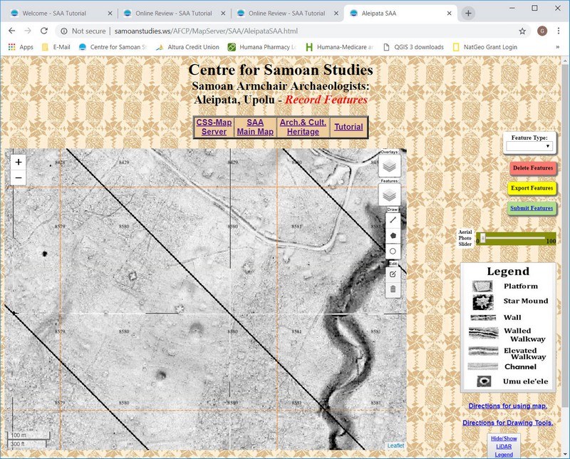
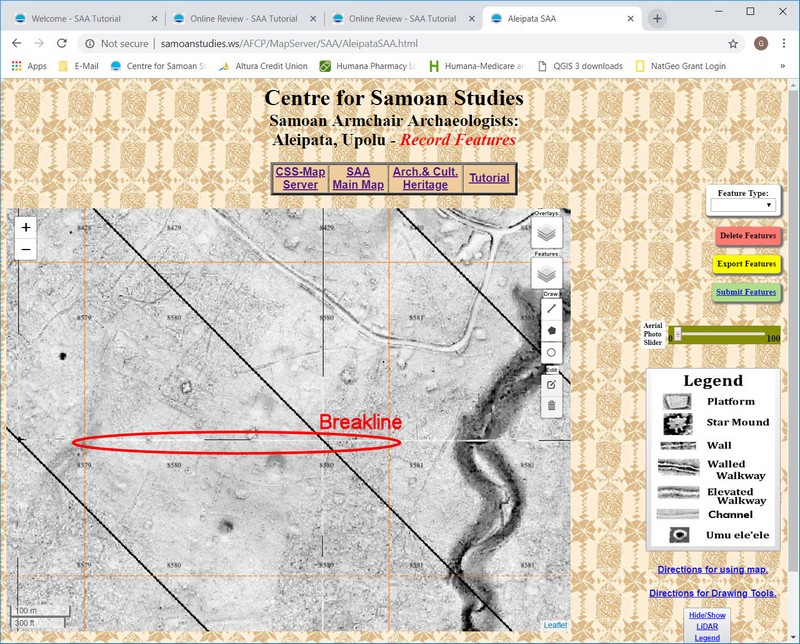
1. Survey Square # 8580 – Aleipata, Upolu;
Location: Lower-SW 1/4
(click on the following link to access the SAA-Main Map and locate your survey square).
(for this review draw only the features in the lower/southern half below the “breakline” in the photo.

2. For this review you will mark and submit only three feature types:
a. Walls (click on Walls Link to compare your work).
b. Platforms (click on Platform Link to compare your work).
c. Earth Ovens (click on Oven Link to compare your work).
[All features can be seen at this link.]
3. Submit your files to CSS.
|
Remember, you should not remark the features that have alrady been recorded (in this case most, but not all of the Earth Ovens).
Do not be discouraged if you have found more or less features than are shown on the supplied “answer maps”. Keep in mind, those "answer maps" were done by a human.
This work is very subjective and far from scientific. During the "pedestrian surveys" that CSS has done (that's archaeology talk for walking through the plantation) they have found three to five times more feature than they could see on the LiDAR images before the survey. Keep in mind, LiDAR only gives us a fleeting glimpse of what may be there, not a complete picture of everything that will be found.
When your submitted work has been checked/reviewed you will be assigned a new Survey Area by email, and be given access to the “SAA – Main Map” section of the Samoan Armchair Archaeologist web page. As you complete and submit each assigned Survey Area your data will be added to Utu and you will be assigned a new one by email.
Welcome to a unique group, the Samoan Armchair Archaeologists.
Good Luck!!
|
|

