|
III. Assigned Study Area (Grid)
With the entire archipelago of the Independent State of Samoa to be surveyed/recorded, a structure is needed to allow data to be entered into the system in an efficient manner. Therefore, the islands have been divided up into a grid system of numbered 500m by 500m survey squares. Participants will be assigned one of these survey squares in which to concentrate their survey.
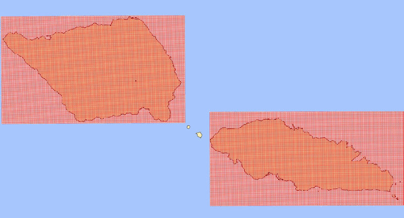
This section/tutorial discusses how to find a particular ”Square” in the “Survey Grid” and put the available tools to best use. A specific example will be used to illustrate the procedure.
In this example we will locate Survey Square # 8736 in the Aleipata map section of Upolu.
Assignment Information : Survey Square # 8736 – Aleipata, Upolu
Location: Lower-Center part of Aleipata map section
|
|
|
1.
|
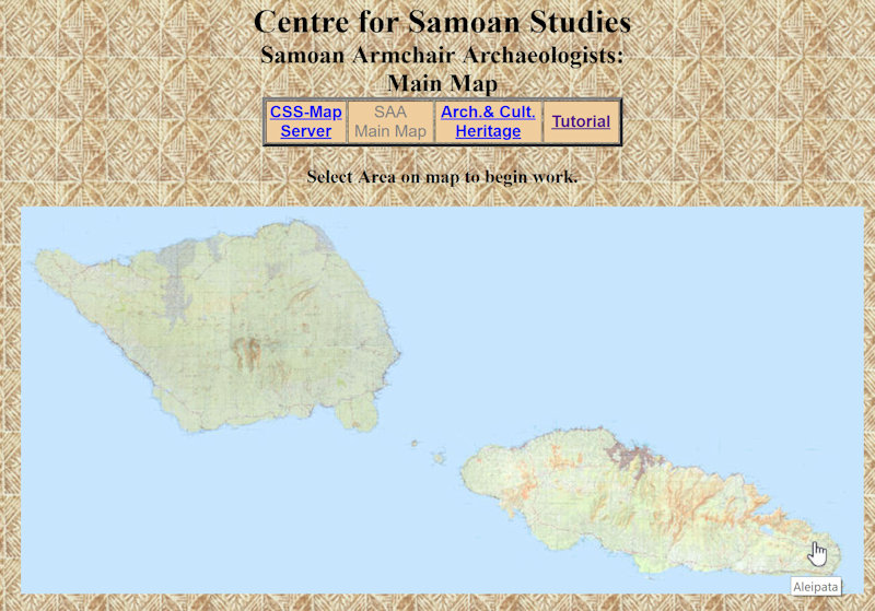
The first task is to find Aleipata, Upolu on the SAA Main Map page. This can easily be done by passing the mouse/hand slowly over the map until “Aleipata” is located, and then clicking on the map to load the Aleipata map section.
|
|
|
2.
|
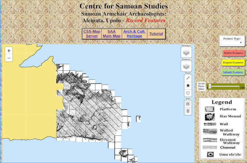
This will open the Community Input Application page for Aleipata, Upolu.
|
|
|
3.
|
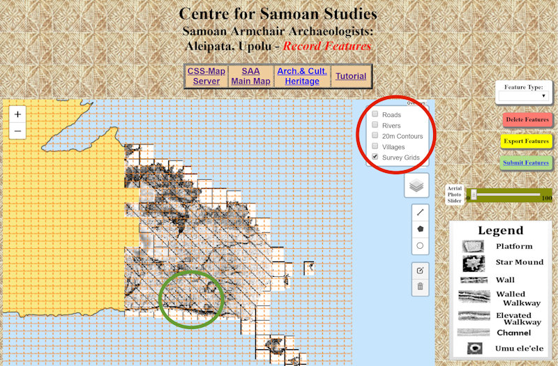
Turn on the Survey Grid by selecting it from the Overlays menu on the upper right corner of the map (Red Circle).
|
|
|
4.
|
As per the Assignment Information: Survey Square # 8736 – Aleipata, Upolu ; Location: Lower- Center, the Survey Square is located in the Lower-Center portion of Aleipata (Green Circle above).
|
|
|
5.
|
Zoom in on the assigned area to enlarge the grid and revile the Survey Square numbers.
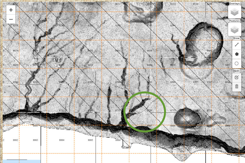
Locate # 8736 (Green Circle above). This is the area to be surveyed.
|
|
|
6.
|
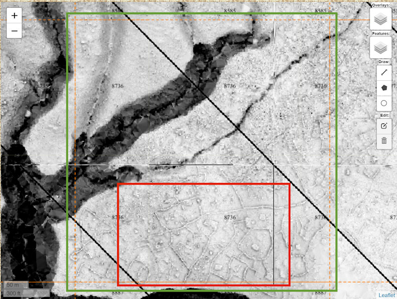
Enlarge the area again to get a better view of the orange Survey Square (outlined in green) and some of the archaeological features (red square) that will be recorded.
|
|
|
7.
|
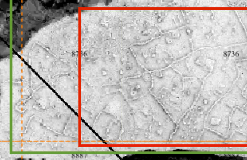
Now that the Survey Square has been located, zoom in as necessary to gain a clearer view of the archaeological features in the survey square.
|
|
|
8.
|
Before doing the actual vectoring/marking of the features there is one more thing to check. Go to the Features menu on the right side of the map and turn on the different features to see what archaeological features have already been recorded in this survey square.
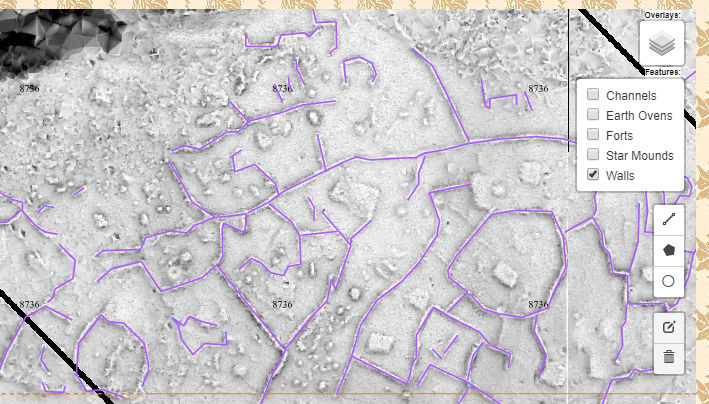
You can leave the "already vectored" Features from the Features menu turned on as you draw the new features to reduce duplication.
Remember the features in the Features menu have to be updated (by the CSS staff) before your new work will be shown.
|
|
|
The actual marking/vectoring of the archaeology sites/features will be covered in the next series of tutorials.
|
|
|