[In conjunction with the US Embassy]
Samoan Heritage Project/AFCP
| Samoan Heritage Project |
Publications and Presentations |
LiDAR Map Server |
Academic Research - ArcMAP |
Academic Research - QGIS 3d |
Quick Tour Map |
Archaeological Survey Data:
[Survey Maps Created in ArcMap and viewable with ArcGIS Explorer]
To view the maps on this web page you must download the CSS Samoa BaseMap.zip [23 MB] file and unzip it to the "C:\CSS_GIS_Explorer" directory you make on your C: drive. (You MUST use this directory for maps to work.) You only need to do this ONCE. This is the base map upon which all the other maps are drawn. |
|
and published references for the cultural /archaeological sites surveyed in 2016 by the Centre for Samoan Studies. (Unpublished) 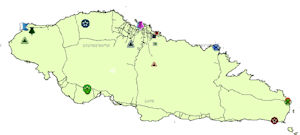
Download: Upolu2016.zip [21 MB] [Last updated: 20 Jan 17] (Directions for use of Upolu2016 map files.) |
Data spreadsheets (.xlsx) [From:"Archaeology in Western Samoa, Vol. 1": Pp. 61-68 (1969)] Savaii, Samoa 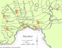
Download: G_D Savaii.zip [3.7 MB] [Last updated: 20 Jan 17] (Directions for use of G_D Savaii map files.) |
Letolo & Sapapalii Plantation Road [From: "Samoan Village Patterns: Four Examples": Journal of the Polynesian Society: Vol.91(1982), No.1,pp81-102 & "Archaeological Excavations in Western Samoa": Pacific Archaeological Records No.32(1980),Appendix: Sapapalii Settlement] 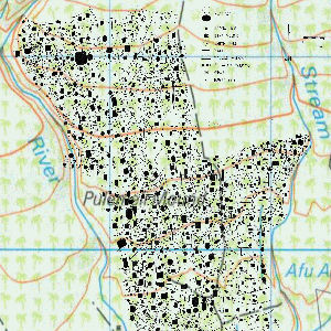
Download: Jackmond78.zip [50 MB] [Last updated: 20 Jan 17] (Directions for use of Jackmond78 map files.) |
|
(1976) [From: "Excavations on Upolu Western Samoa": Pacific Archaeological Records No.25(1976) and "Archaeological Excavations in Western Samoa": PAR No.32(1980)] Upolu, Samoa 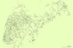 [Last updated: 30 Jan 17] Mt. Olo map files.) |
(Modern Village 1978) [From: "Samoan Village Patterns: Four Examples": Journal of the Polynesian Society: Vol.91(1982), No.1,pp81-102] Savaii, Samoa 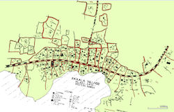
Download: Faaala Village.zip [3.5 MB] [Last updated: 20 Jan 17] (Directions for use of (Faaala Village map files.) |
CSS 2017 Savaii Survey Area, GPS Coordinates, Google Maps & Sample Data Form(.xlsx). A “rough” exploratory survey, using a modified checker board grid with LiDAR, Google Maps, and a quick on the ground GPS point survey of the selected blocks to get an idea of the platform density and layout in the Palauli area to compare with what was found at Letolo and Faaala. 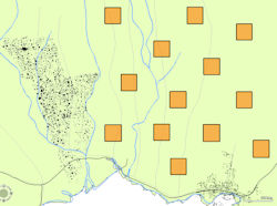
Download: Savaii2017.zip [12 MB] [Last updated: 20 Jan 17] (Directions for use of Savaii2017 map files.) |
|
Preliminary Data. of Vaitoomuli and Faaala, Palauli District, Island of Savaii, Samoa. Collected by CSS field class between 4 April 2017 & 8 April 2017. [unpublished] 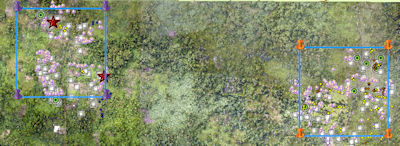 [Last updated: 24 AMay 17] Palauli Survey 0417 map files.) |
with Possible Settlement Overlays Savaii, Samoa. Images: bare earth / hillshade (DEM) format.[unpublished] Overlays show approximate, possible settlement extent. [see "Directions for use..." below]. 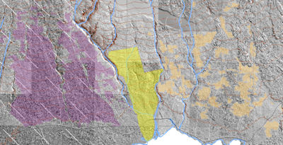
Download: PalauliLiDAR.zip [40.8 MB] [Last updated: 24 May 17] (Directions for use of Palauli LiDAR map files.) |
|
|
Make sure to check for updates and additions for the latest information (see "Last Updated" date under each download link). Comments and/or suggestions can be sent to: g.jackmond@nus.edu.ws |
||