Walled Walkways, consist of a pathway between two parallel rock walls. The parallel walls of the walkway, as with single walls, may vary greatly in both height and width. The adjacent walls may be dissimilar in size and or shape. The walkways are usually 2 or more meters wide. These were presumably used, as the name implies, as corridors of human transport, but in many instances go far beyond the basic level need to accomplish such a task. In some locations they are often overlaid by modern roads leading from the village into the plantation, although many still lay undisturbed in the plantation land above the modern villages. They reach deep into the upper reaches of the village land (and possibly beyond). Their lateral branches sometimes connect to adjacent pathways producing a network of interconnected walkways (also see Elevated Walkways in this tutorial which serve a similar purpose and are often parts of this network). It is not uncommon for an extensive walkway to alternate between walled and elevated sections. It has been assumed that they play an important role not only in basic transport but also in emphasizing social status. They have been found throughout Samoa. For a more complete description see the References at the end of this tutorial. In the following photos we have tried to make the reader familiar with what these walled walkways look like not only on LiDAR, but also at ground level and in aerial photos. |
|
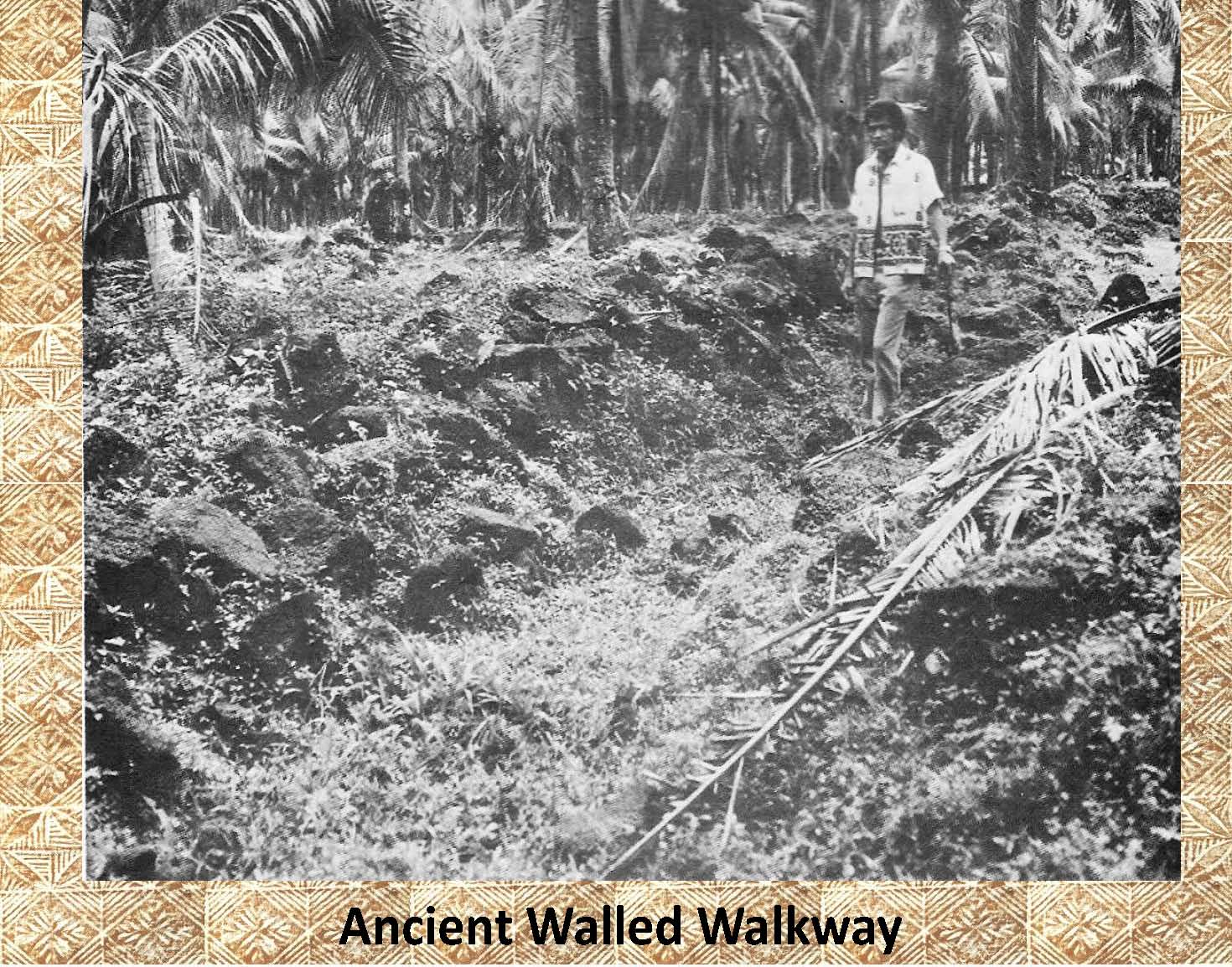
In this photograph of a walled walkway from the Mt. Olo survey (Jennings 1974) even though the walls are badly collapsed you can still see the pathway which runs between them. | cent
|
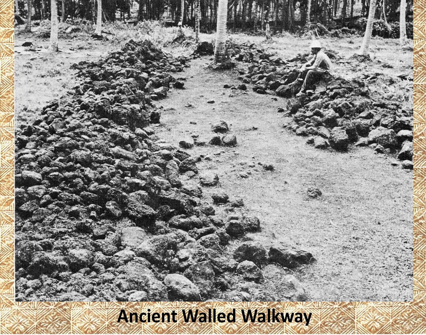 |
In this photograph, also from the Mt. Olo survey, all the vegetation has been removed and you can clearly see a wider walled walkway, again the original walls are badly collapsed. |
|
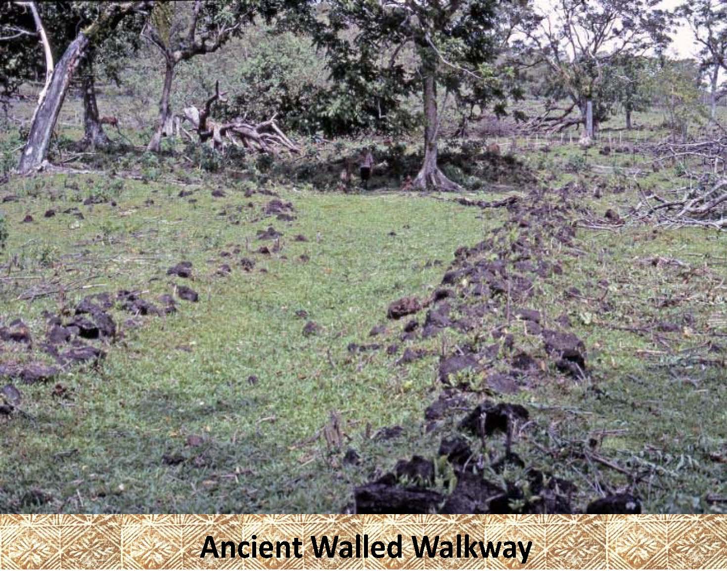 |
This is another example of a walled walkway from the Ologogo area of Savaii. It also displays the collapsed walls seen in the other two photos. Notice the man in the background under the tree in the center of the photo for scale. Also note the disparity in wall size between the wall on the left and the right of the walkway. This may have been part of the original design (?) or due to the reuse of the rocks from the original wall for another project (wall or platform). |
|
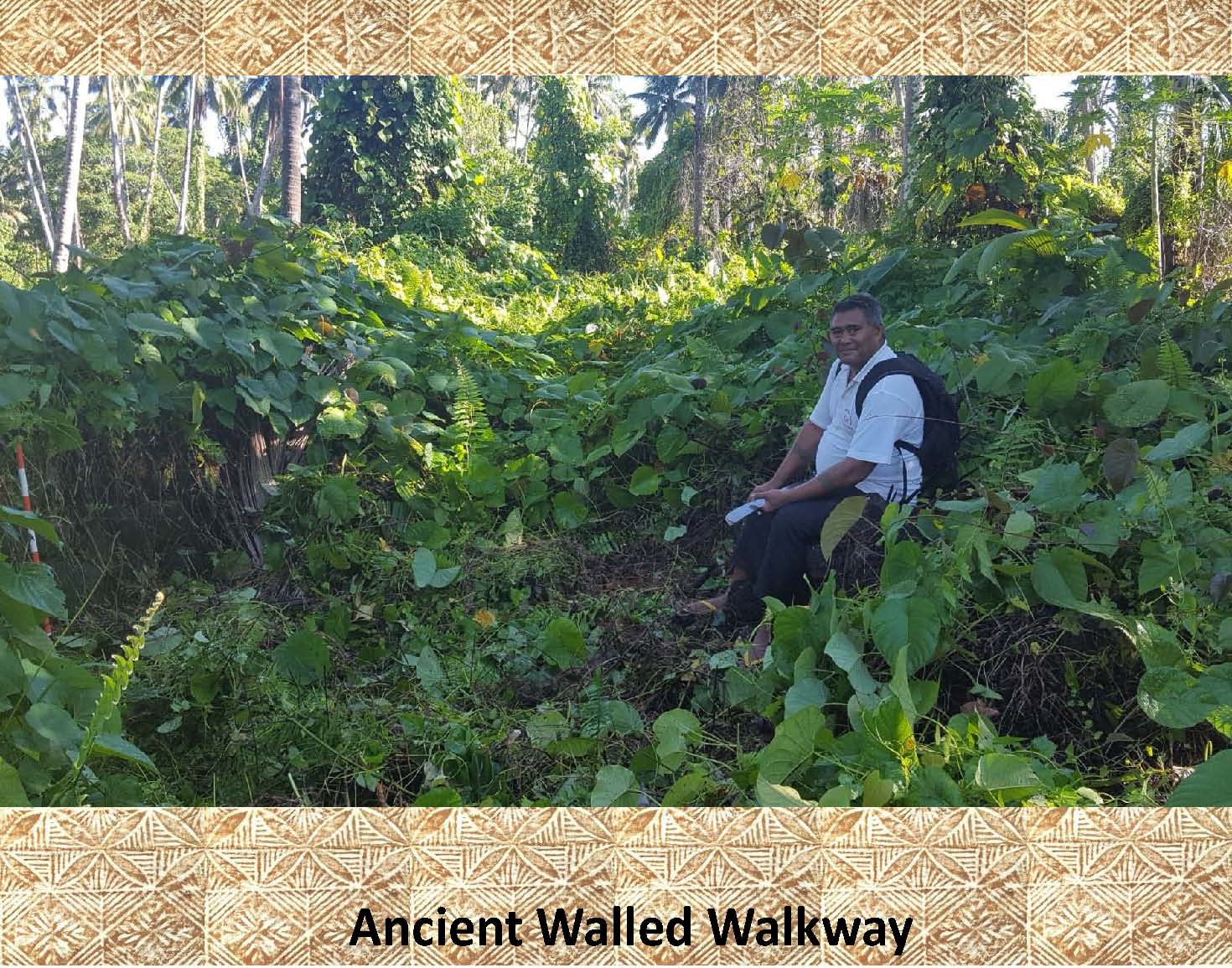 |
Here is an example of a walled walkway from Vaitoomuli, Savaii, before it has been cleared of vegetation. Notice the 1 meter orange and white photo scale on the left side of the photo showing that the left wall is straight and over 1 meter tall, while the pulenuu (mayor) of Vaitoomuli sits on the collapsed right wall. |
|
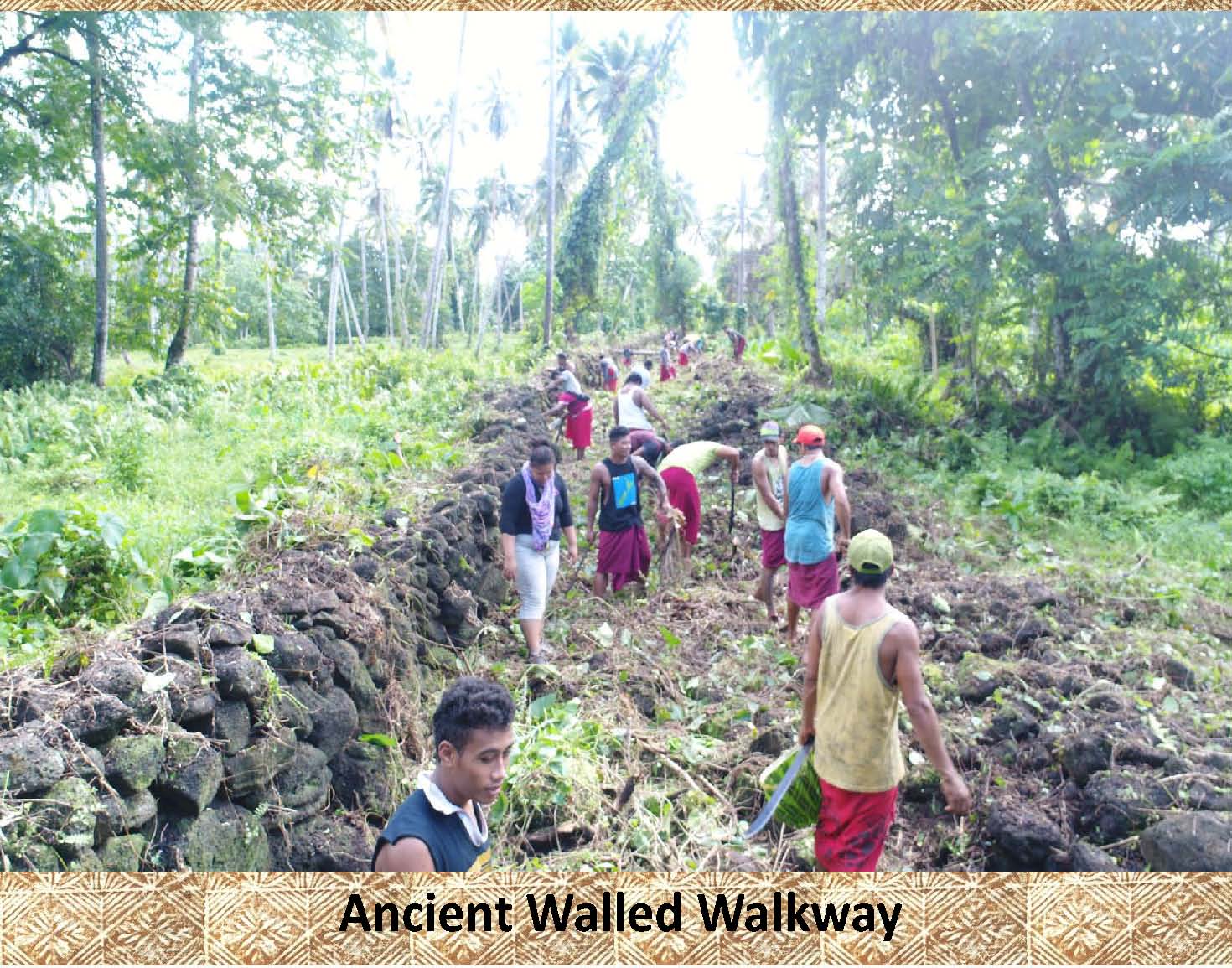 |
This photo shows the aumaga (untitled men) clearing the walkway shown above. Again noticed the differences in the walls on the left and right. The left wall appears to have been reconstructed recently to act as a boundary marker. |
|
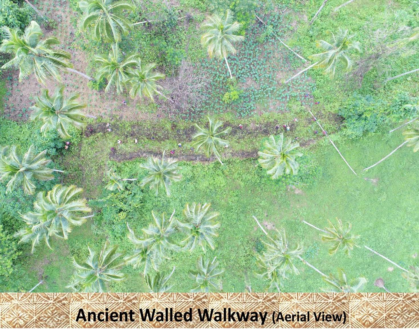 |
This drone photo shows what the walled walkway (dark areas/rock walls) looks like from above as it is being cleared. |
|
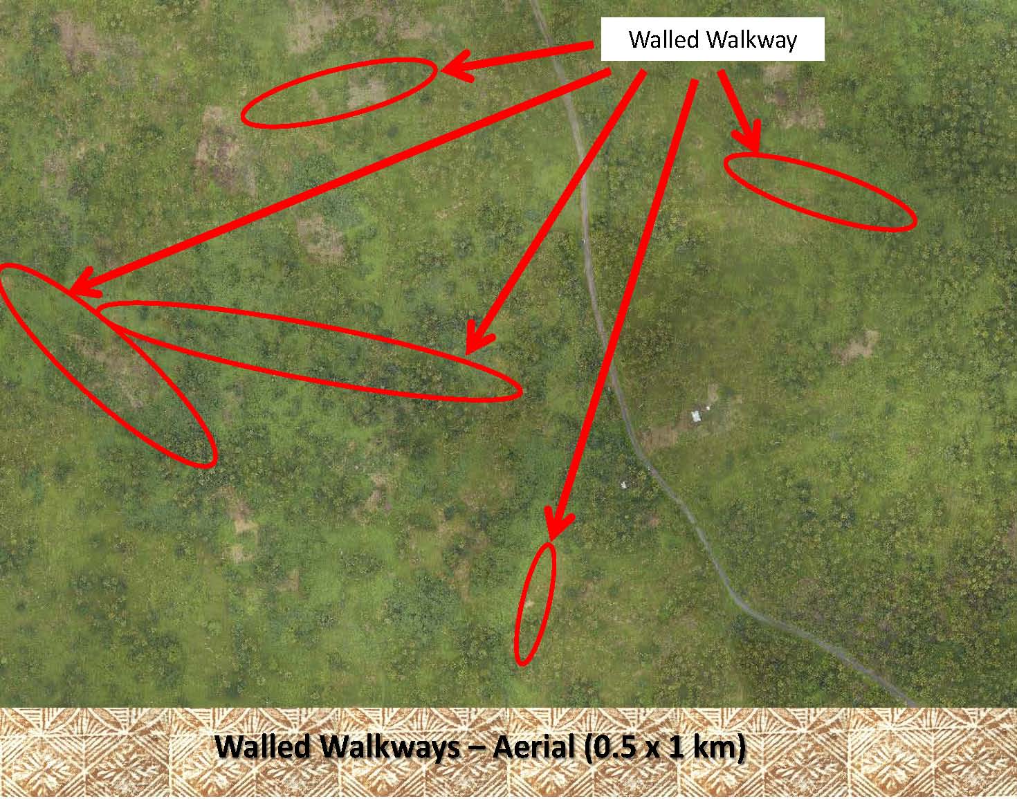 |
Though difficult to see, this aerial photo shows portions of several of the walled walkways in the Palauli District of Savaii. |
|
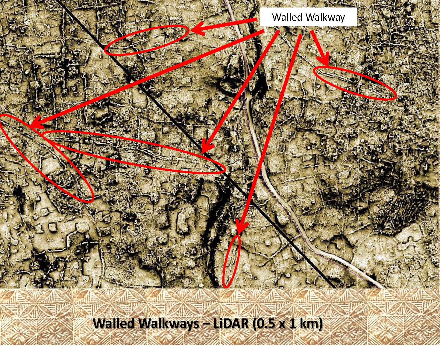 |
With this LiDAR image (of the same area as above) the walled walkways are easily visible. Notice the parallel lines in each highlighted section showing the parallel walls that make up these walled walkways. Upon closer inspection you can see that these walkways may have at one time connected to form a network of walkways. |
|
|
References: Additional information about walled walkways can be found in the following publication: Green and Davidson (1969) Archaeology in Western Samoa, Volume 1, P 38 Green and Davidson (1974) Archaeology in Western Samoa, Volume 2, Pp 238-240 Jennings, etal (1980) Archaeological Excavations in Western Samoa |