The following described of terraces by Davidson (G&D Vol.1 P 228) gives a good summery of their description and use: "It has been suggested that terraces were used both for residence and for agriculture. A terrace is essentially a leveled area of sloping ground which has been constructed to permit activities which could not comfortably be carried out on the unmodified slope. Samoan agriculture today is practiced on very steep slopes; it therefore seems unlikely that terracing was constructed primarily for agriculture. On the other hand, unoccupied terraces would have been used for agriculture, as they are today, as part of the rotation cycle which moves over any available cultivable land within reasonable reach of settlements. Terraces, however, have been constructed in the first instance as a base for activities other than agriculture." Terraces are an ubiquitous feature over many of the hillsides and ridges throughout Samoa. Though they can be difficult to see on aerial photos they can be easily observed on LiDAR (see the examples below) and ground surveys. In the following photos we have tried to make the reader familiar with what these terraces look like not only on LiDAR, but also at ground level and in aerial photos. |
|
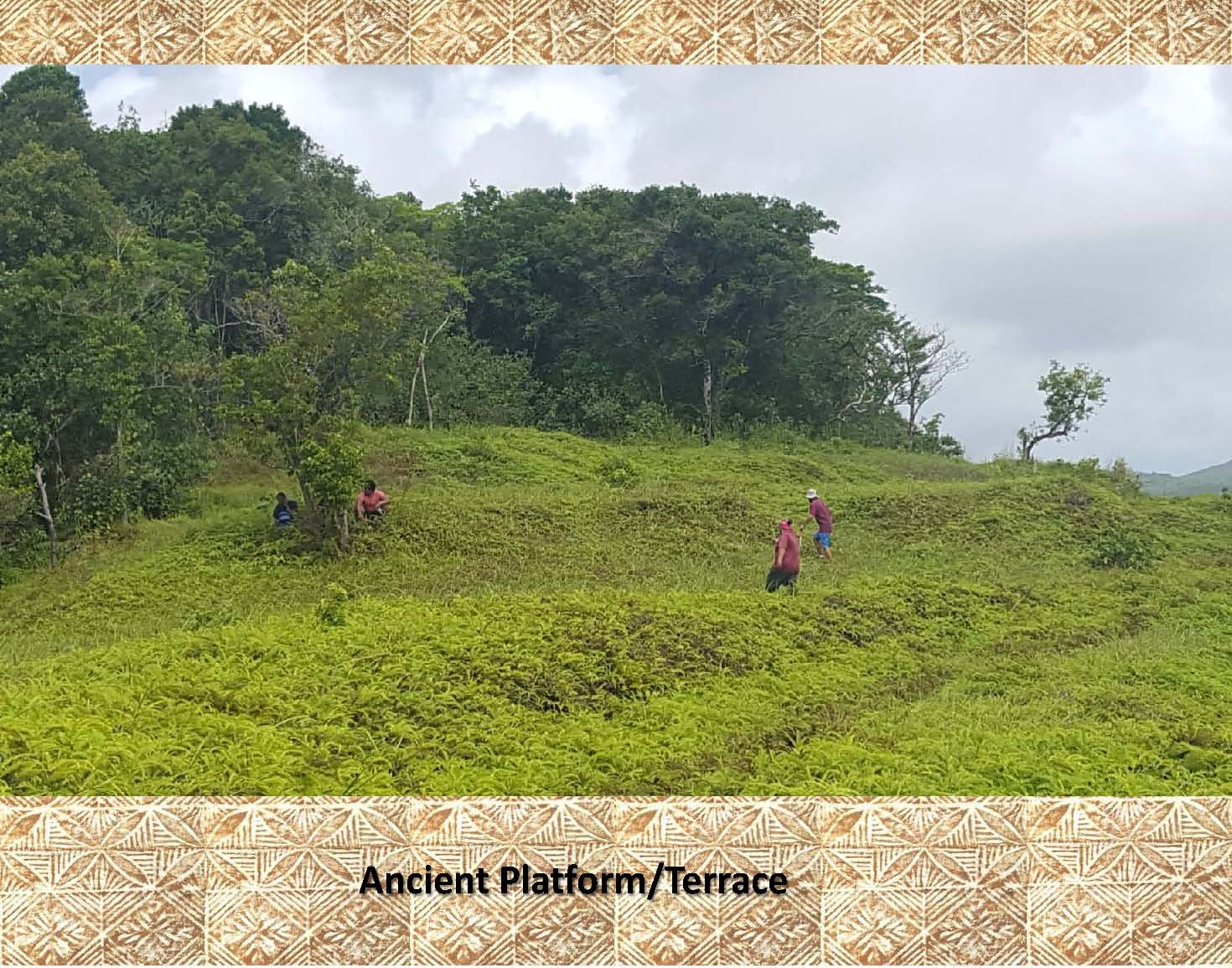
This is a classic example of a large terrace in the hills to the north of Samusu, Aleipata, Upolu. It is only one of several which cover the opposite side of this hillside beyond the tree line as shown in the aerial photos and LiDAR image below. |
|
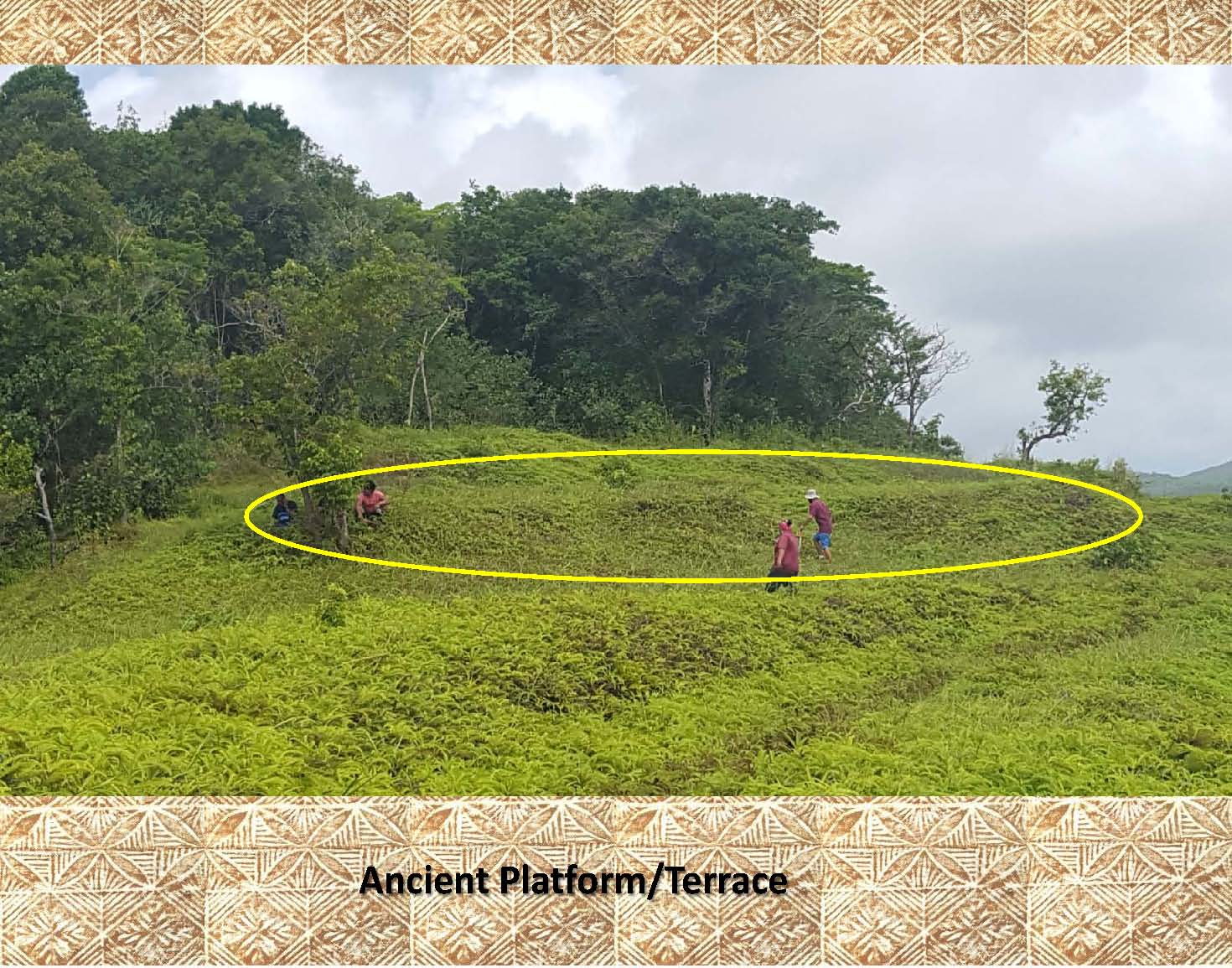 |
In this photo the terrace has been highlighted for easy recognition. Notice the people in the photo for scale, and the flattened area (terrace) just above the people in the middle of the photo. |
|
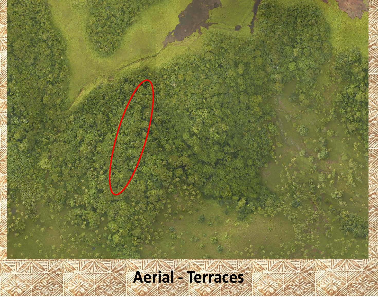 |
Here is the back side of the hill photographed in the last photos. The above photos were taken from just above the red oval (north) looking to the south. With the heavy vegetation covering this ridge it is impossible to see the 7 terraces covering this hillside. |
|
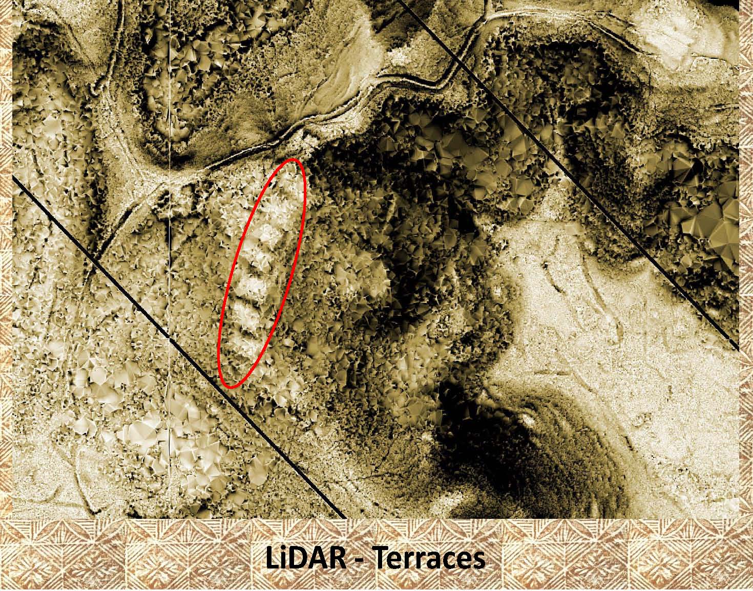 |
In this LiDAR image it is easy to pick out the terraces that are highlighted in red. When visited, some of these terraces show evidence of previous house platforms. |
|
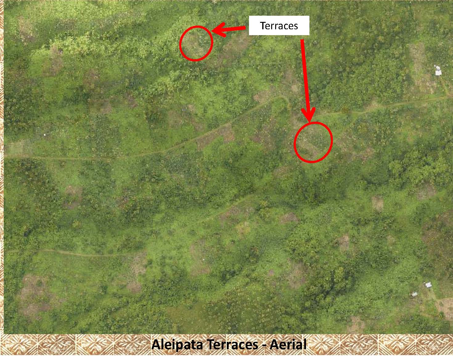 |
It is very difficult to make out the terraces in this aerial photo even when highlighted. |
|
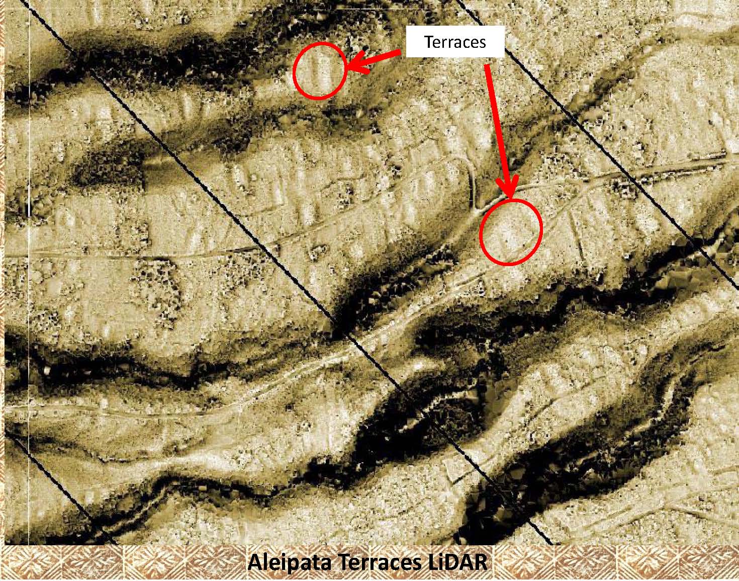 |
On this LiDAR image of the same area as above you can not only make out the 2 highlighted terraces but it is easy to see scores of other terraces in the same area (the light and dark colored ovals/rectangles covering the LiDAR image). Although none of these terraces has been ground checked, they display the same image attributes as the over 30 terraces that have been visited. |
|
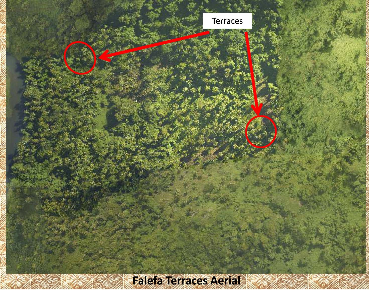 |
All but invisible on this aerial photo, the terraces are easily visible on the next LiDAR image. |
|
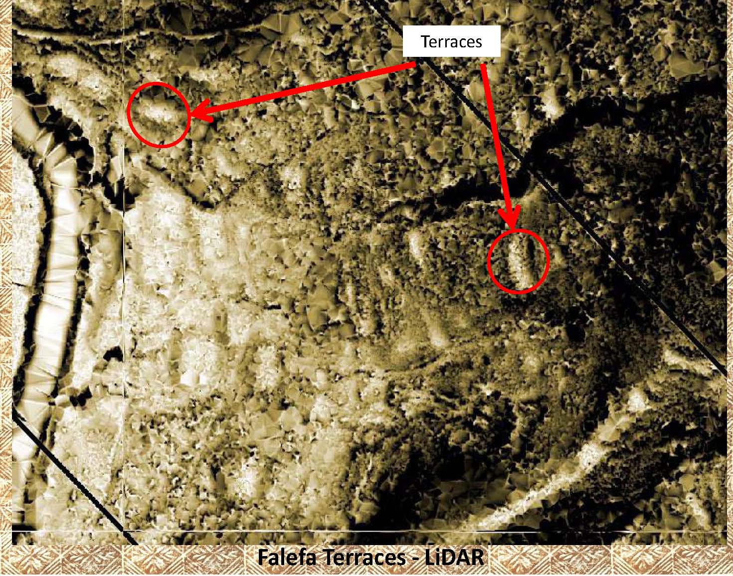 |
As in the other LiDAR images, not only are the 2 marked terraces easily visible, but numerous other terraces can be seen in this image. |
|
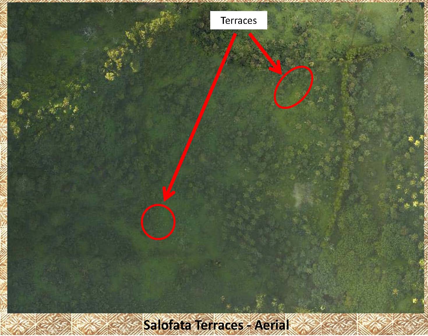 |
More examples of the difficulty of picking out terraces from aerial photos. |
|
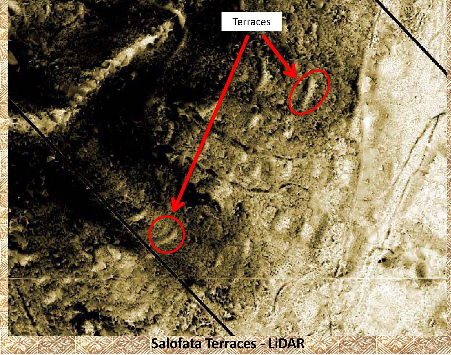 |
This LiDAR image of the above aerial photo makes it easy to not only pick out the 2 terraces that are marked but also the numerous other terraces on the same hillside. |
|
|
References: Additional information about terraces can be found in the following publication: Green and Davidson (1969) Archaeology in Western Samoa, Volume 1, P 41 Green and Davidson (1974) Archaeology in Western Samoa, Volume 2, P 228 |