Platforms have been recorded by archaeologists since they started working in Samoa in the 1950’s and before. Buist on Savaii recorded them as ranging “in size from small rectangular platforms to large low pavements and large high mounds, and included some round and oval structures. Scott also recorded both rectangular and round examples. Platforms at Mulifanua included rectangular and circular examples of various sizes and heights, as well as some which could only be described as irregular or amorphous.” Some archaeologists have divided them into house platforms (platforms for dwellings) and larger mounds (platforms over a certain size used for other purposes). Here we have not divided them by size or use (since there use is still uncertain) and categorized all such structures as simply platforms. They may be made of rock, earth, or a combination of rock and earth. For a more complete description see the References at the end of this tutorial. In the following photos we have tried to make the reader familiar with what these platforms look like not only on LiDAR, but also at ground level and in aerial photos. |
|
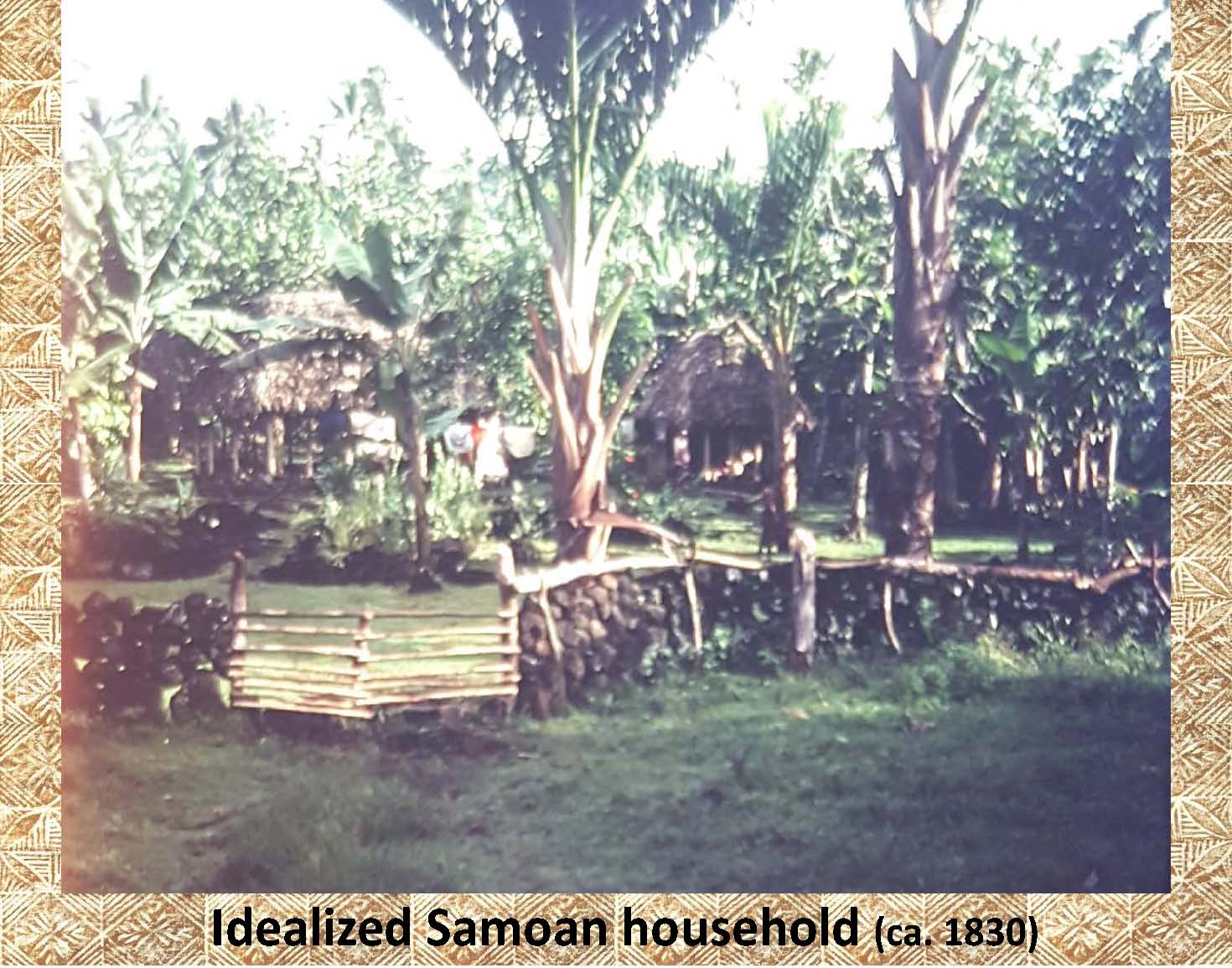
Although this photograph was taken in 1977 it represents the “idealized” Samoan household of the 1800s. Notice the wall in the forground and the houses in the background amoung the breadfruit and bananas. |
|
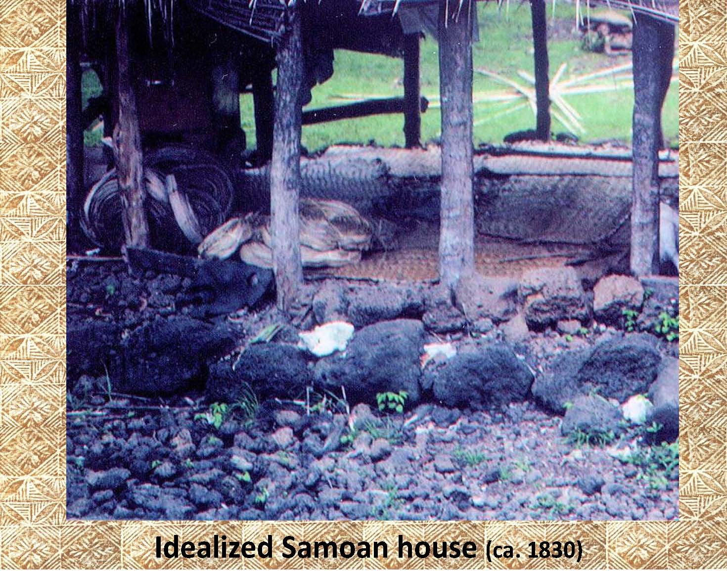 |
This again is another modern photo from the late 1970s, but shows a close up of what many common early Samoan houses are thought to looked like. Notice the ring of stones around the foundation, and the stone paving around the house outline. |
|
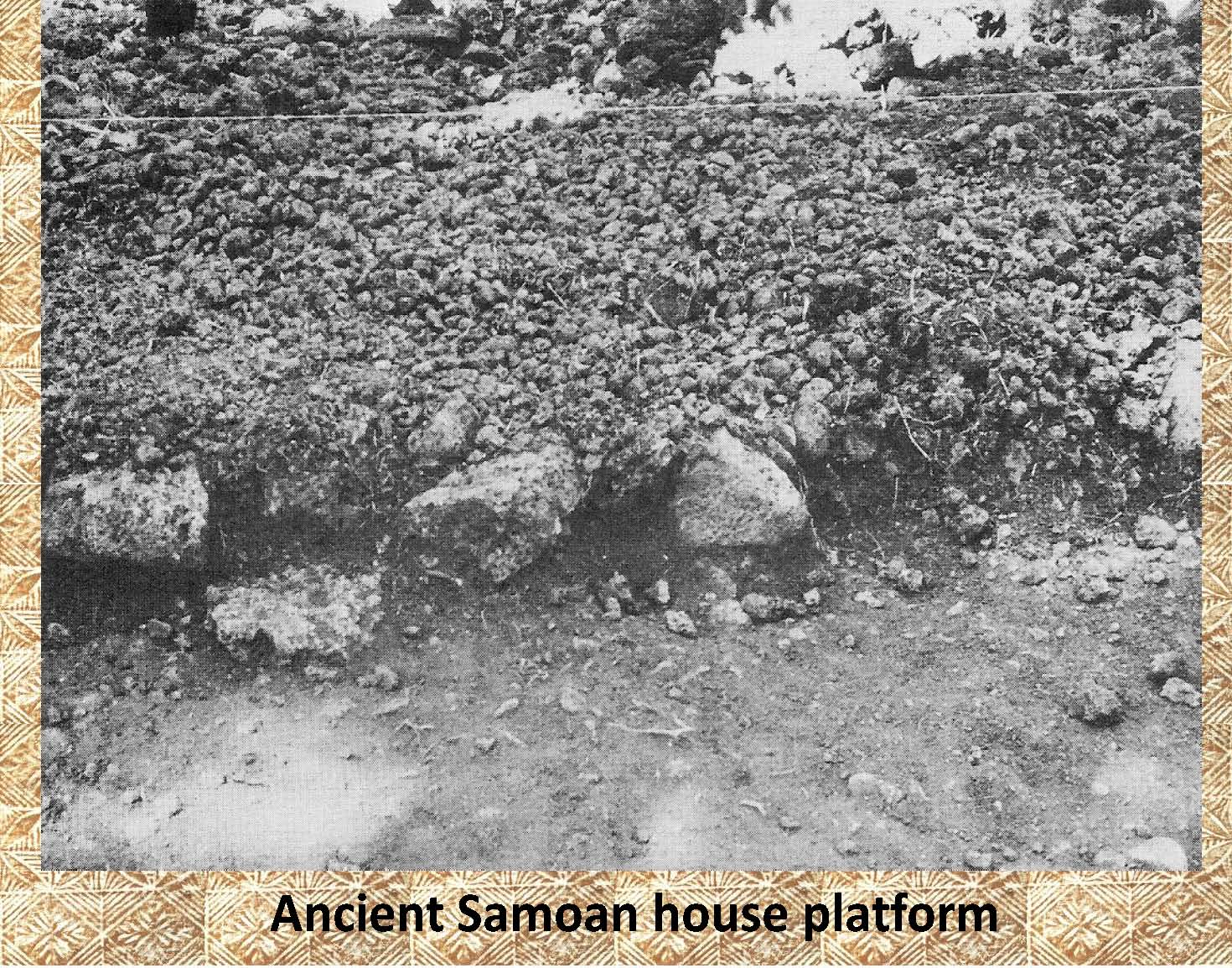 |
Here is an example of an ancient house platform that was excavated at Mt. Olo near Mulifanua, Upolu (Jennings 1980). |
|
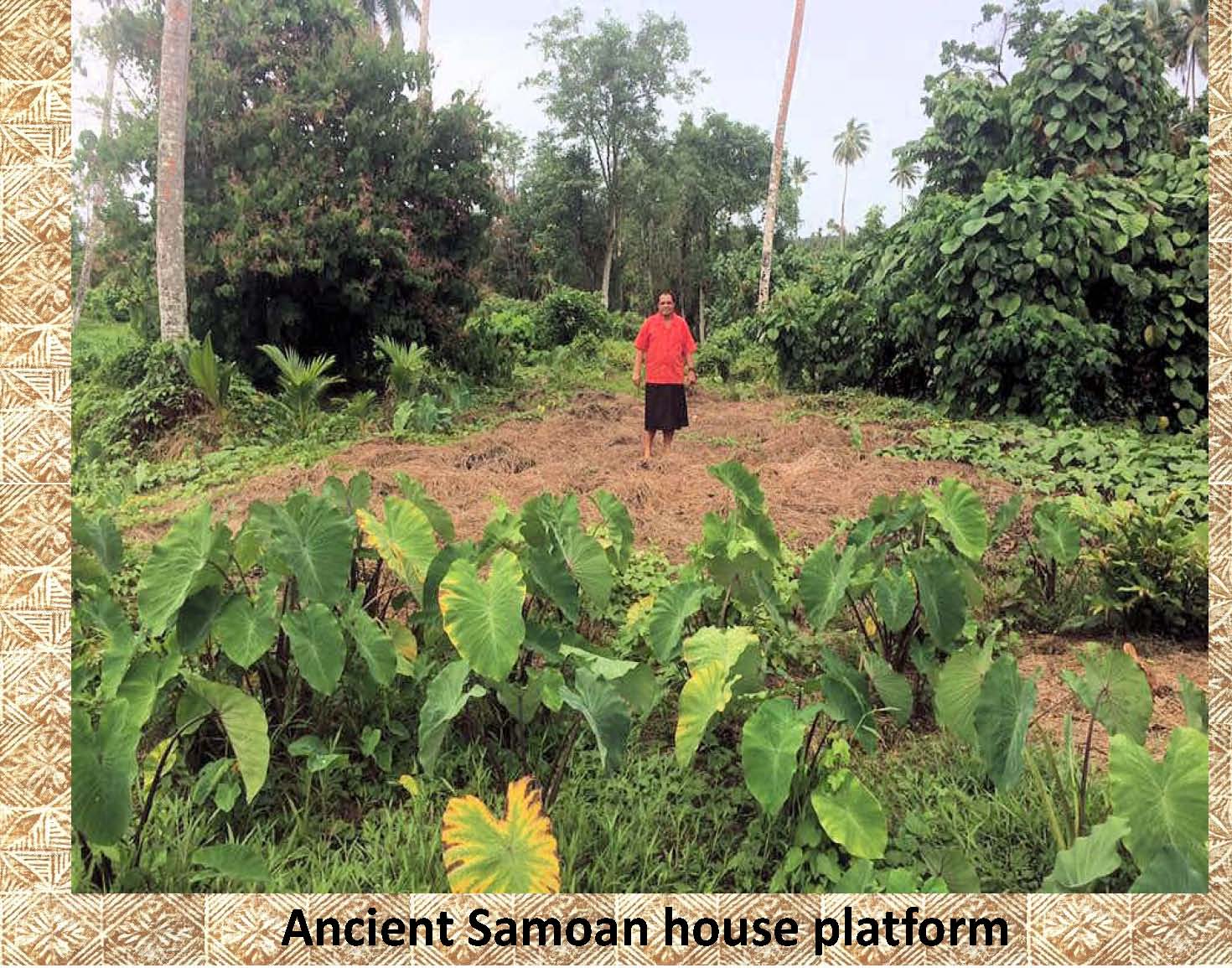 |
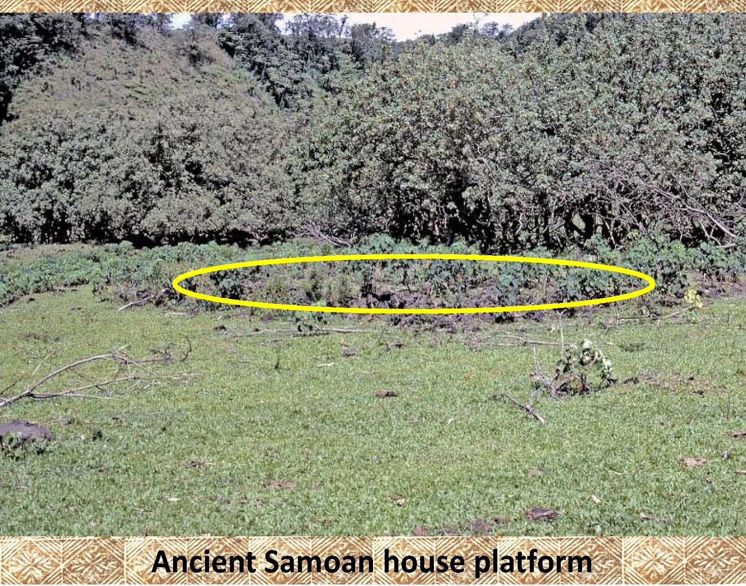
Here is an example of an ancient platform covered with dead weeds. It is difficult to see and has been outlined in the next photo. |
|
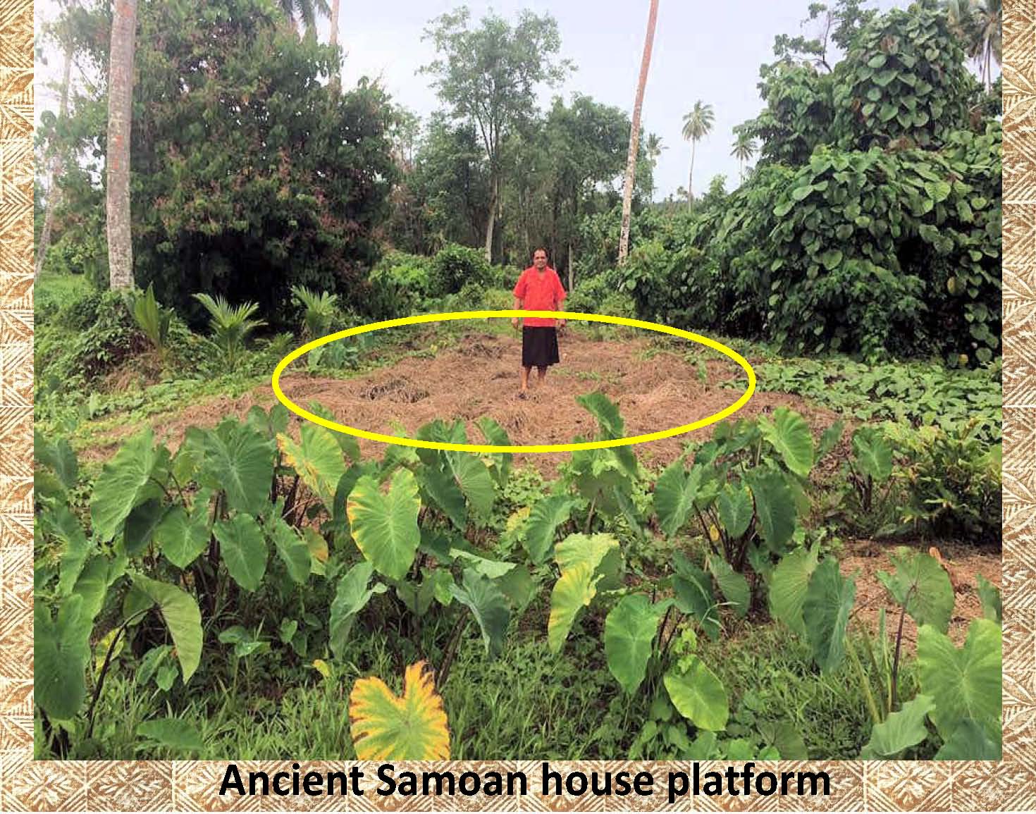 |
Here is the same platform as above, circled in yellow to make it easier to recognize. |
|
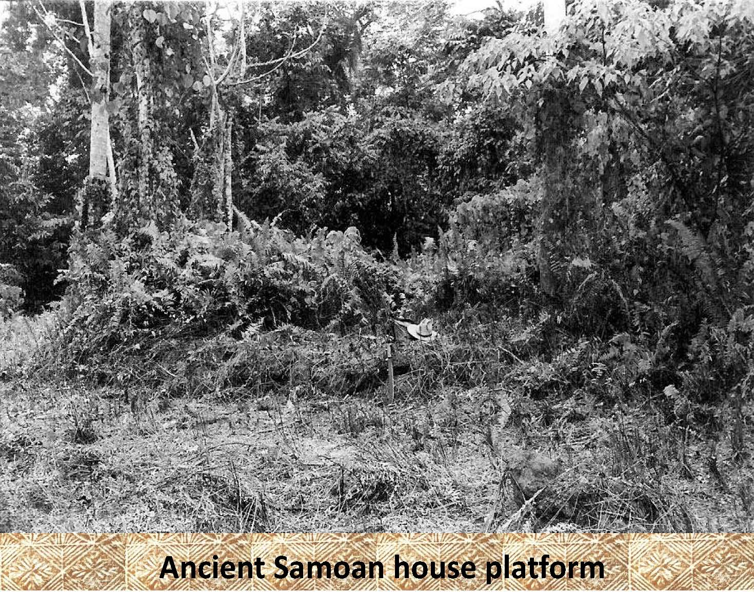 |
This is a photo of a raised platform located in the plantations about 1.5 kilometers above the present village of Sapapaplii, Savaii. It is difficult to see, and was entirely covered with ferns. A portion has been cleared for this photo. Note the hat and machete in the photo for scale. The platform has been outlined in the following photo. |
|
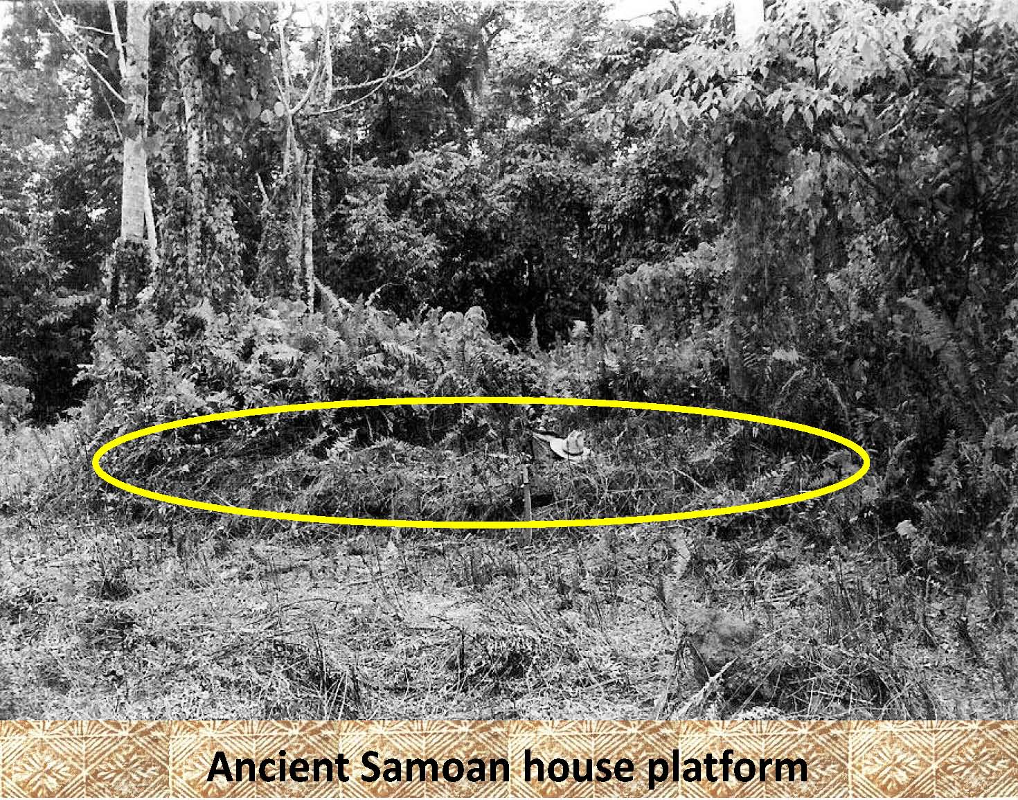 |
In this photo the platform from above has been outlined in yellow to make it easier to see. |
|
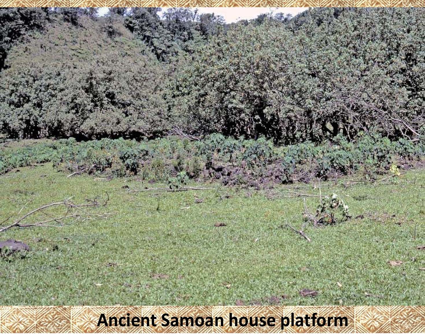 |
Here is another platform. It is difficult to see among all the vegetation. |
|
 |
This is the same platform as above outlined in yellow to make it easier to see. |
|
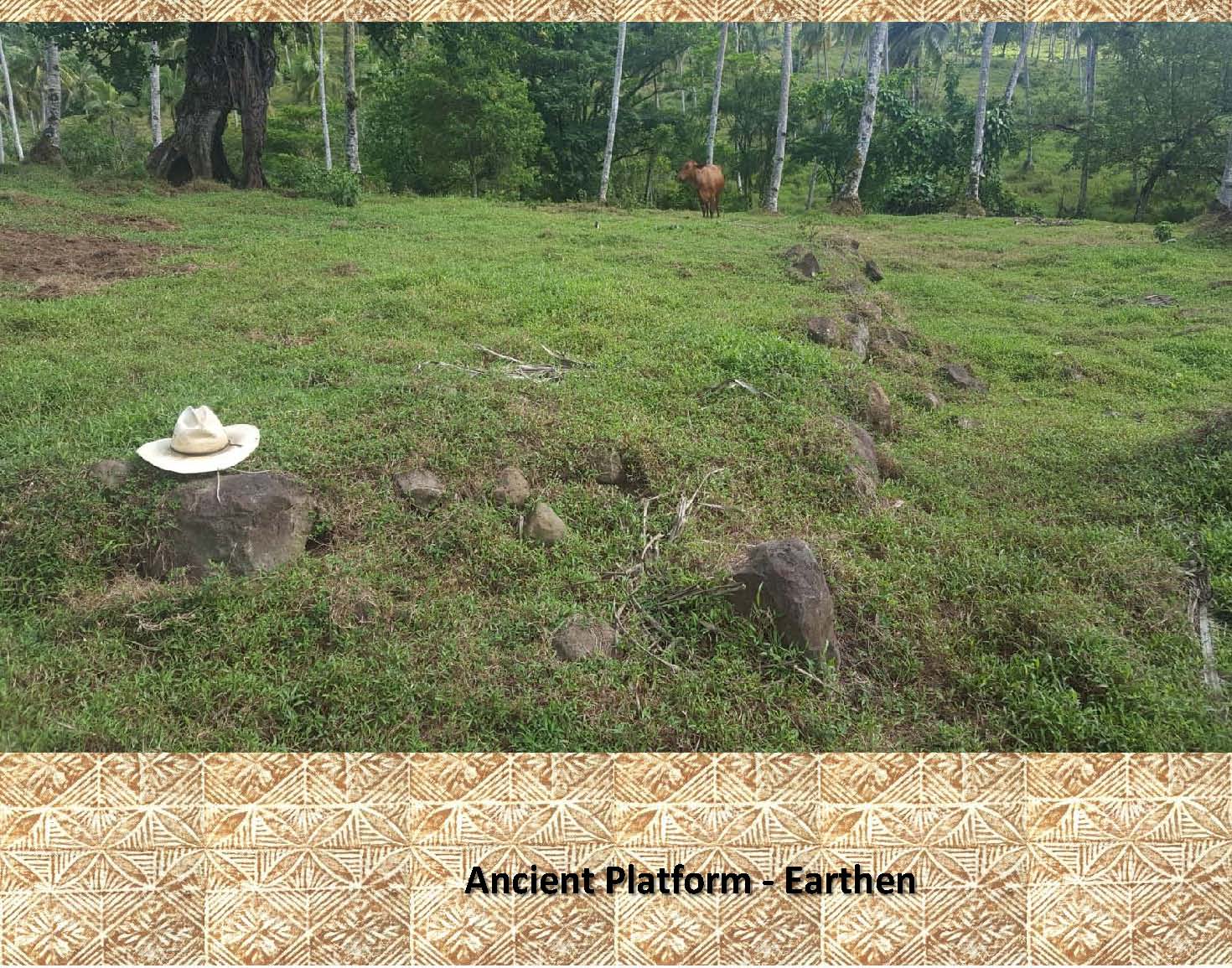 |
This is an example of a platform found in Aleipata, Upolu, where there is less natural rock. Notice how this platform is outlined by a row of stones on the sides and its center filled with earth. Again, notice the hat for scale. |
|
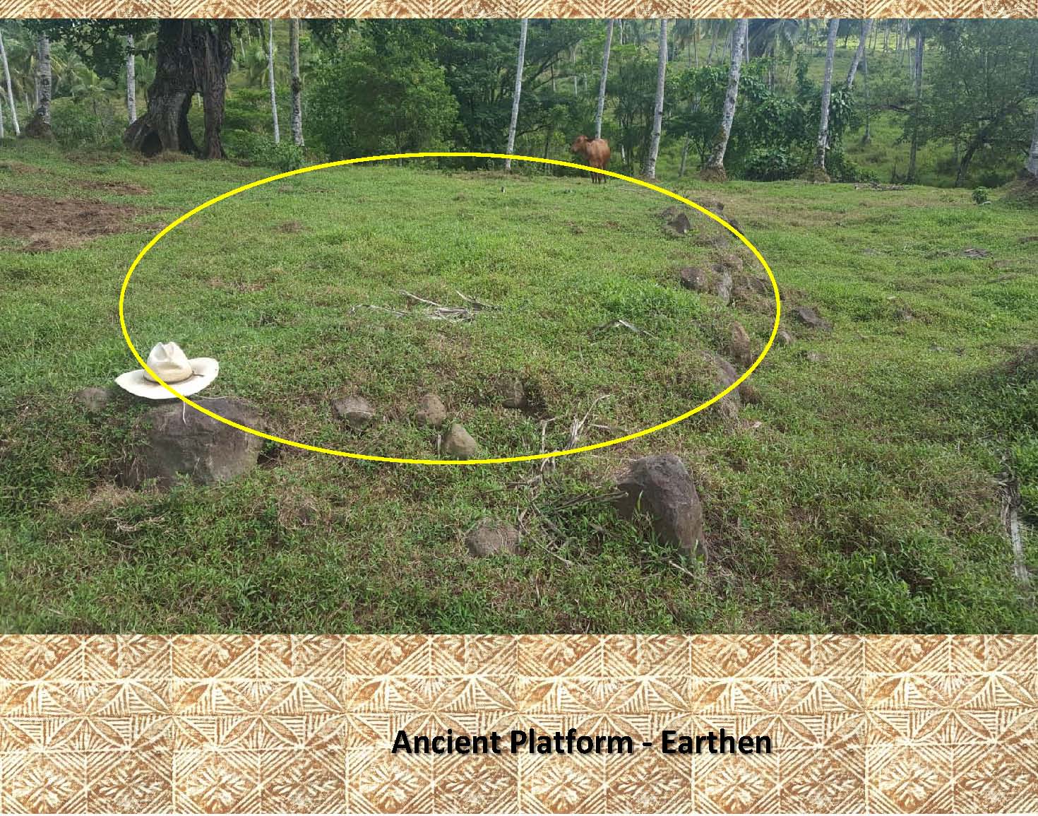 |
Here the above platform has been outlined for clarity. |
|
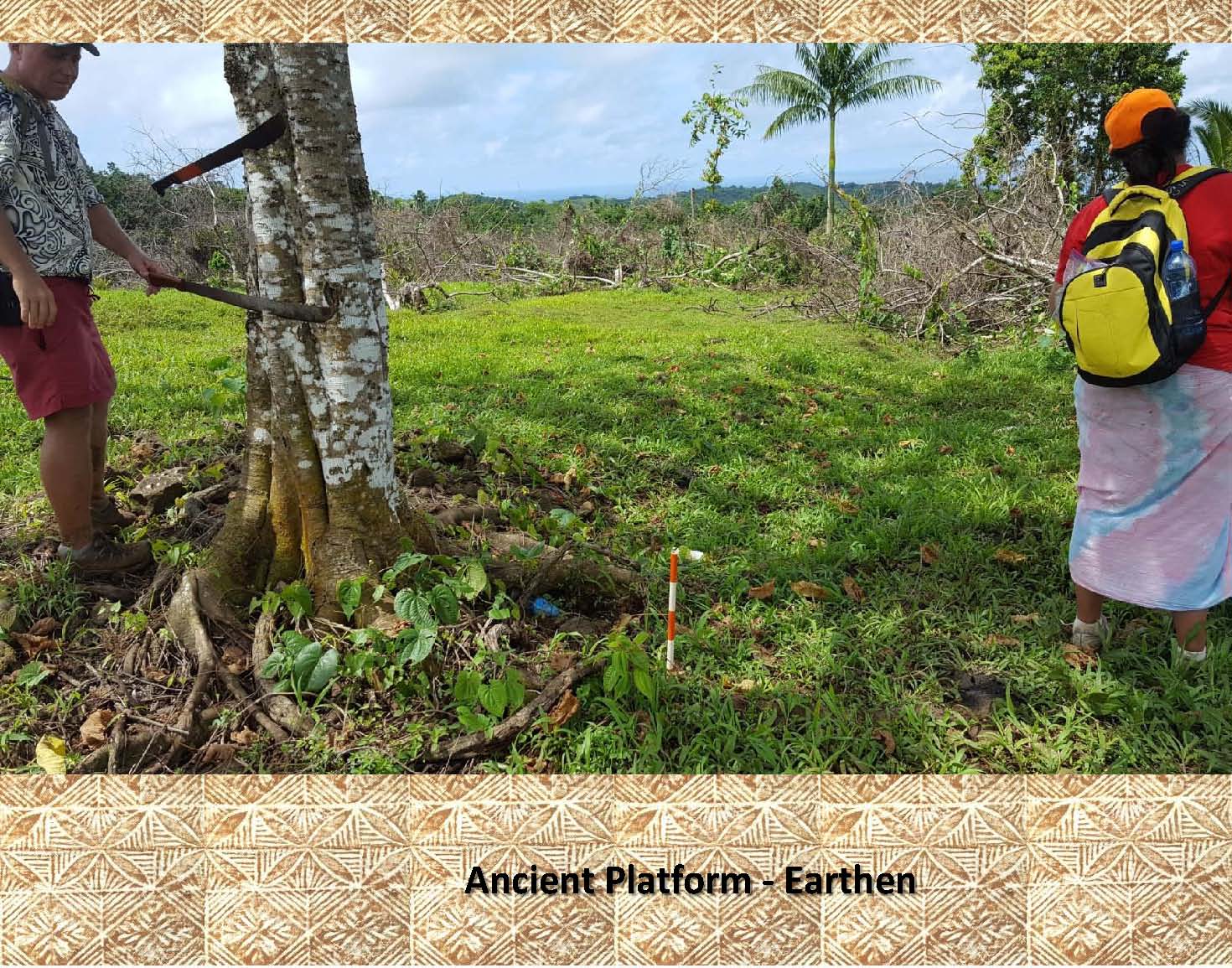 |
This is a photo of an earthen platform from Samusu, Aleipata, Upolu. This platform lacks the rock border seen above, but can be recognized by its raised form. |
|
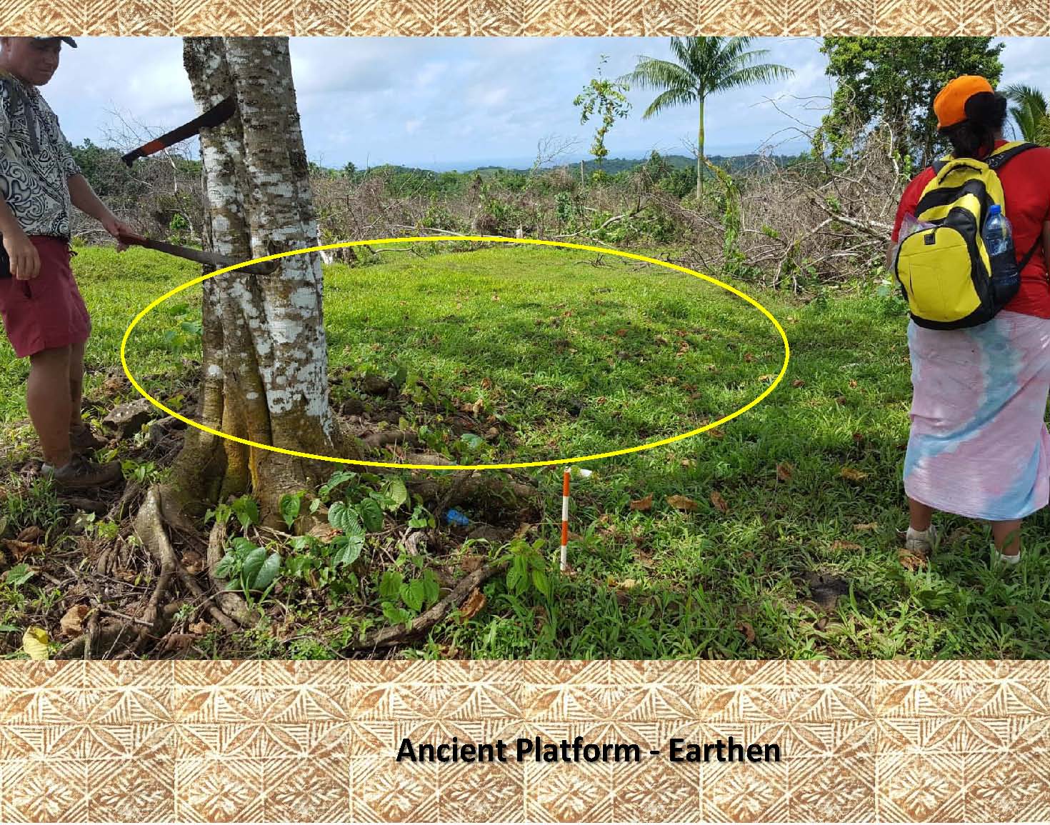 |
In this photo a rough outline of the platform has been marked. Notice the short (50 cm.) orange and white photo scale in the foreground. |
|
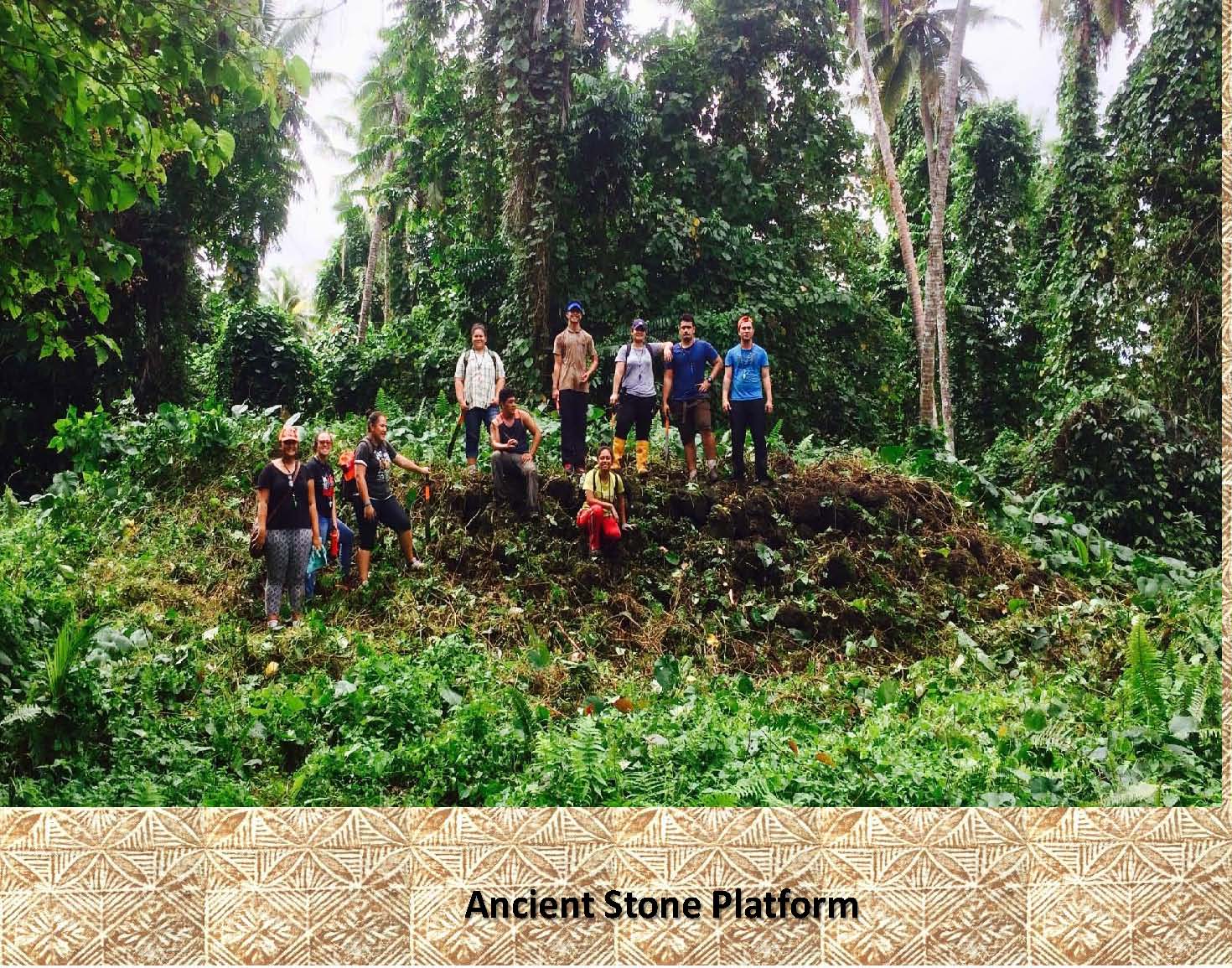 |
Here we have a large 20 meter long 2 meter high stone platform from Palauli, Savaii, where stone is much more abundant. It has been partly cleared of vegetation for this photo. |
|
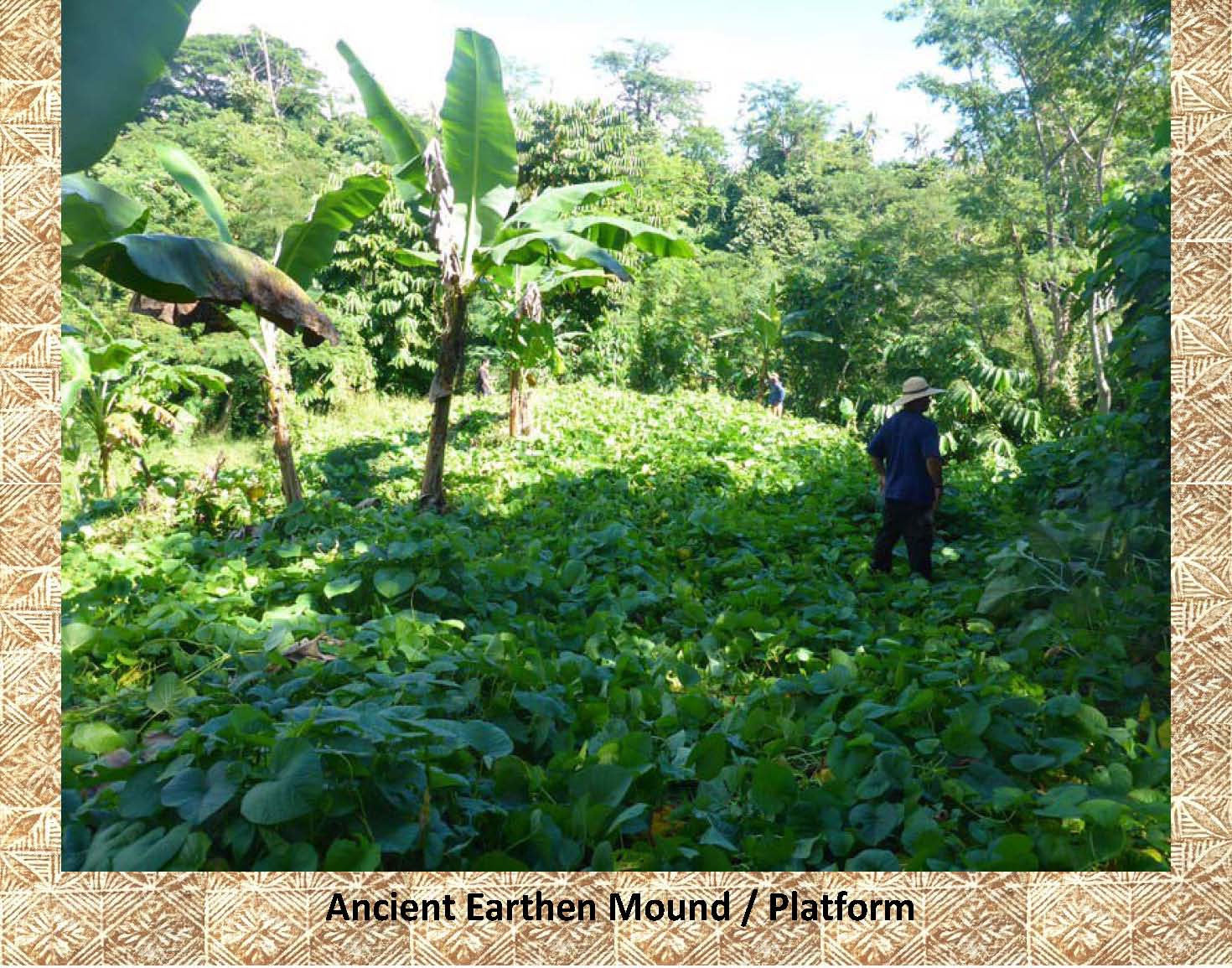 |
Here is another earthen mound covered in vegetation form Upolu. Because of the vegetation it is quite difficult to see. |
|
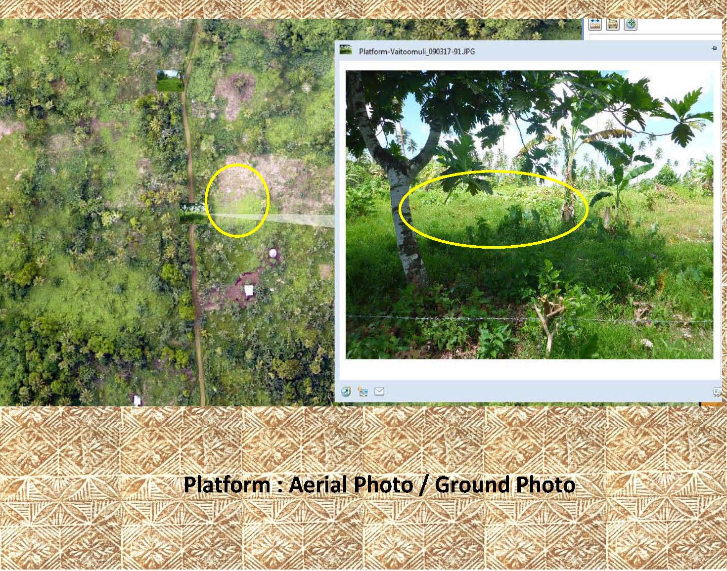 |
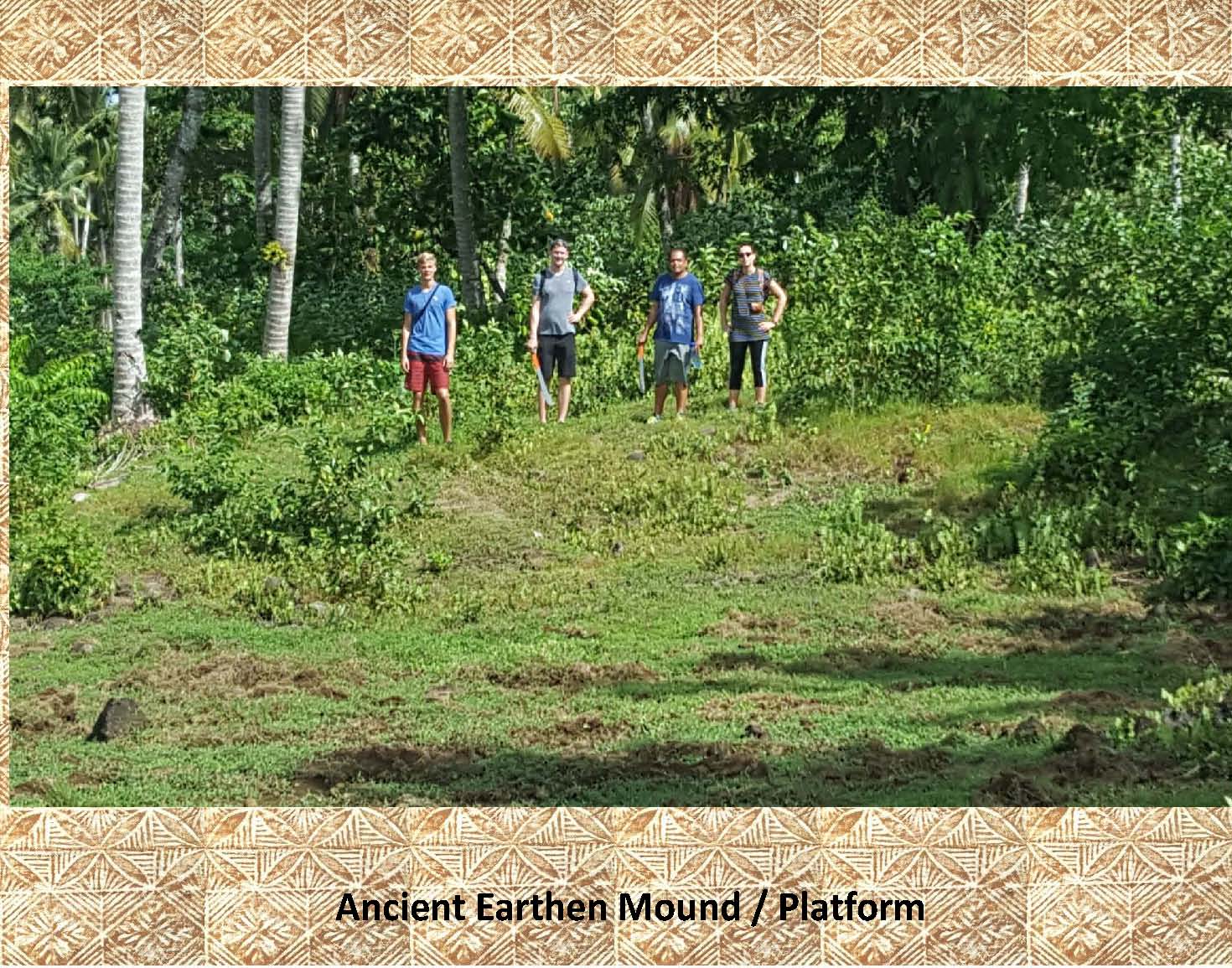
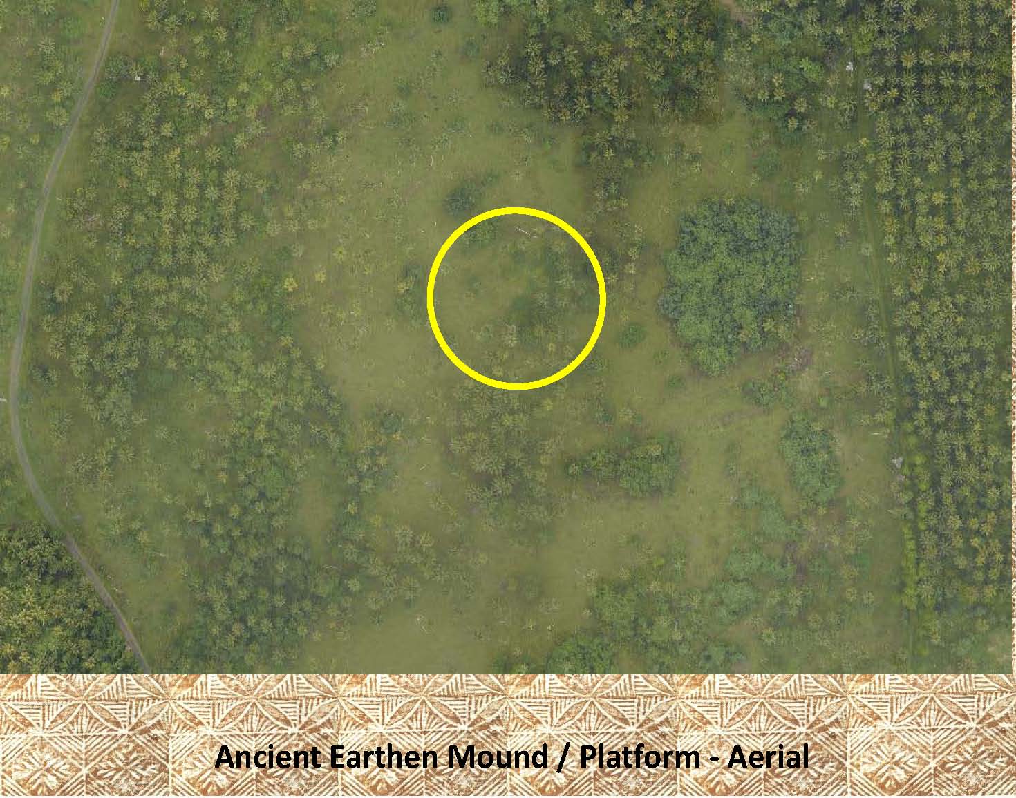
This combo picture shows an aerial view of a platform (left) and its associated ground level photo (right). The platform has been outlined in yellow in each photo to make it easier to locate. |
|
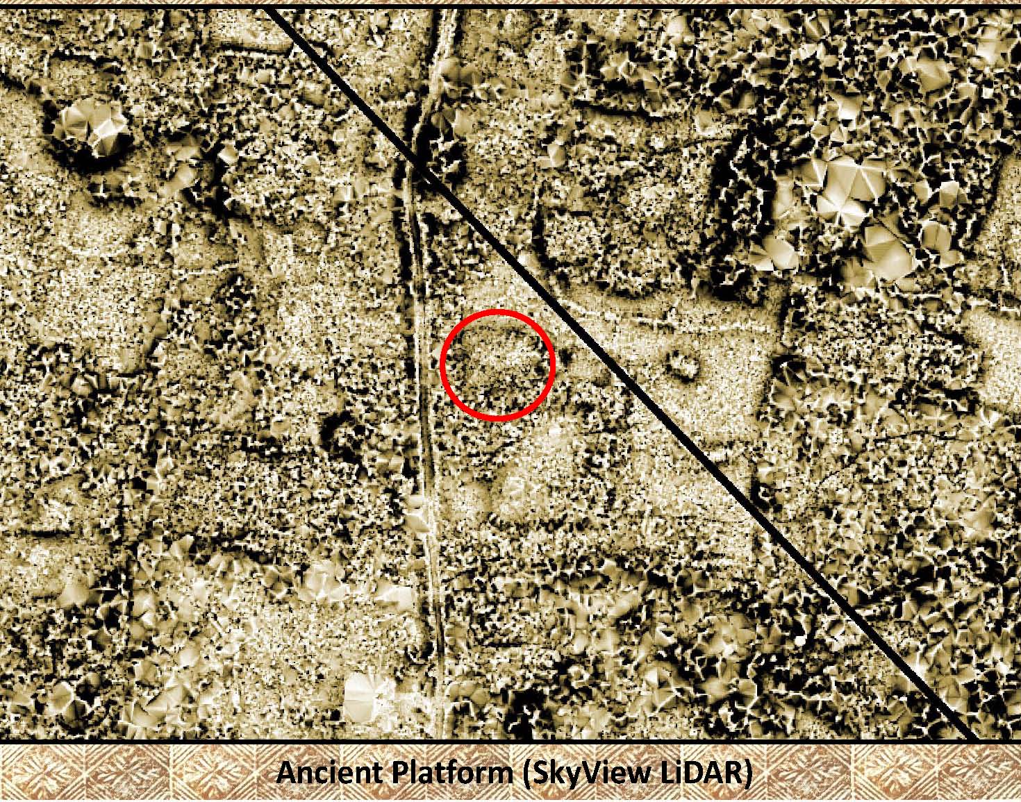 |
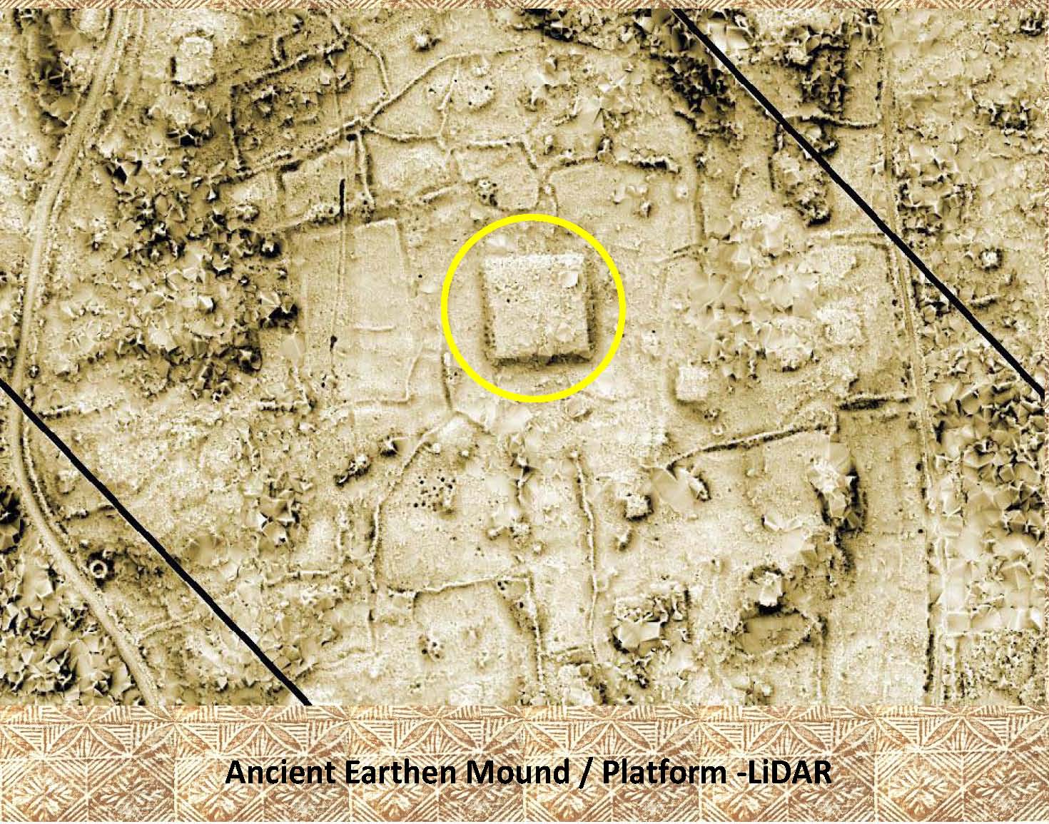
This is the same platform as above as it appears on LiDAR. Notice the other platforms and walls, in the area. |
|
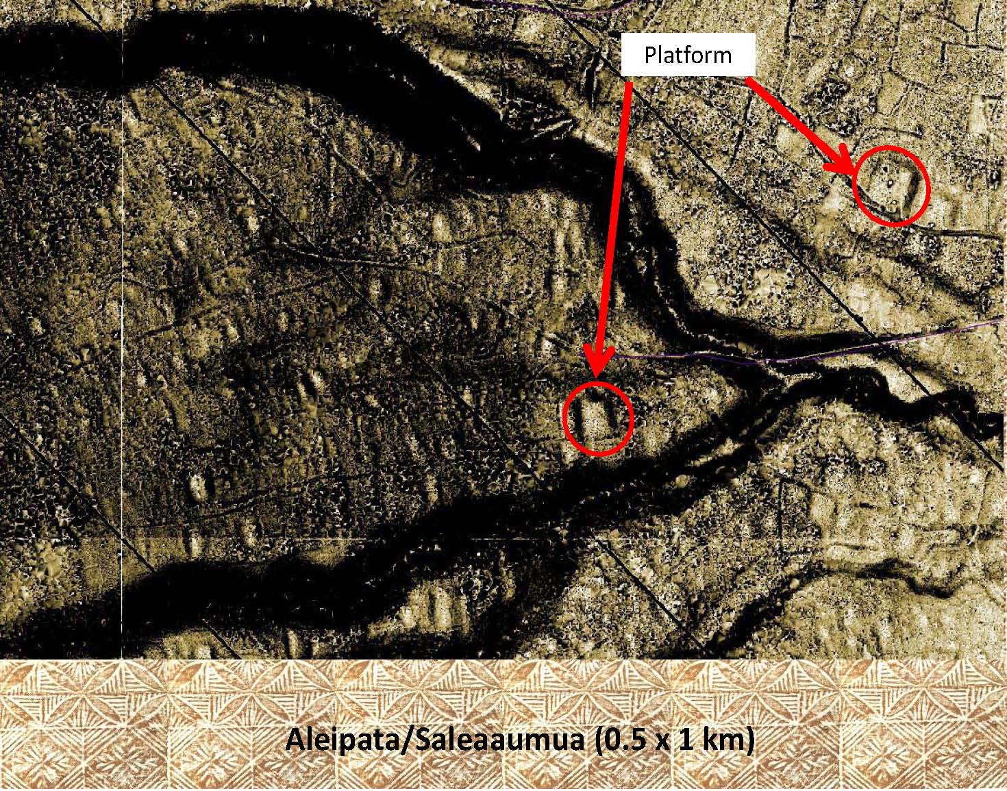 |
Here is a LiDAR image of 2 large platforms found in Aleipata, Upolu. Notice the additional platforms and numerous terraces in the same area. |
|
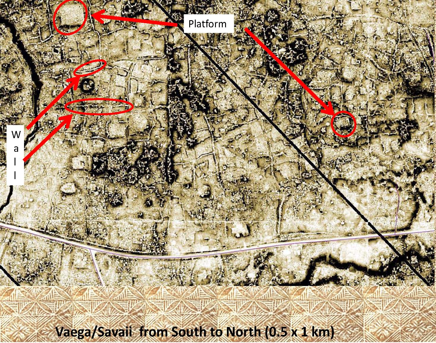 |
In this image only 2 of the platforms and walls are highlighted in red, can you pick out the numerous other platforms and walls. |
|
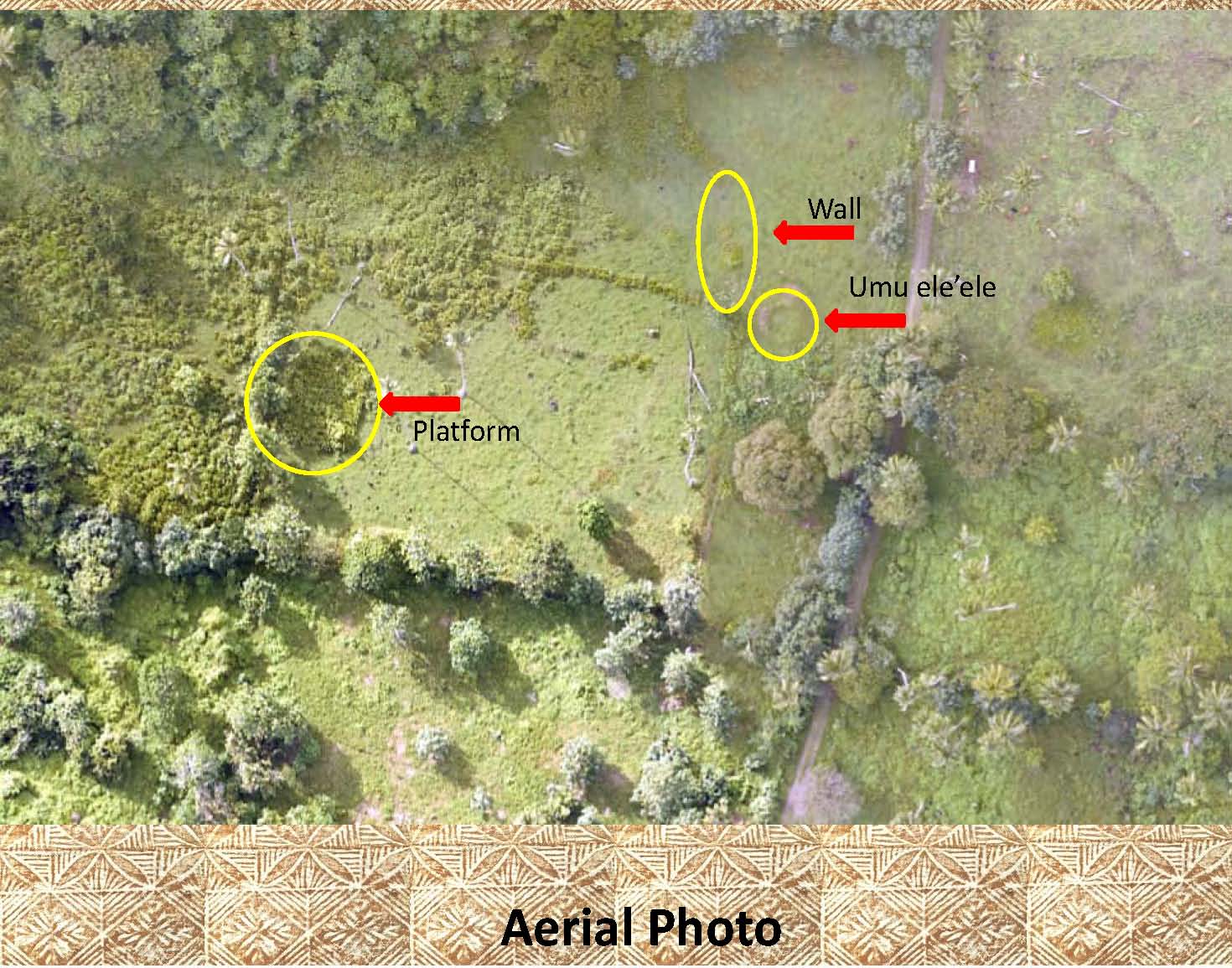 |
This aerial photo shows an area in Faaala, Savaii. Notice the marked features, they are difficult to see, but are highlighted for easier recognition. |
|
 |
This is the LiDAR image of same area as above. Notice how clearly the features stand out. Can you pick out the other features in the area. |
|
 |
The platform in this photo is also from Palauli, Savaii, in the village of Vailoa. It is of an earthen platform that is about 50 x 50 meters in size and over 2 meters tall. |
|
 |
This is the above platform as seen in an aerial photo. The platform has been marked as it is difficult to see. |
|
 |
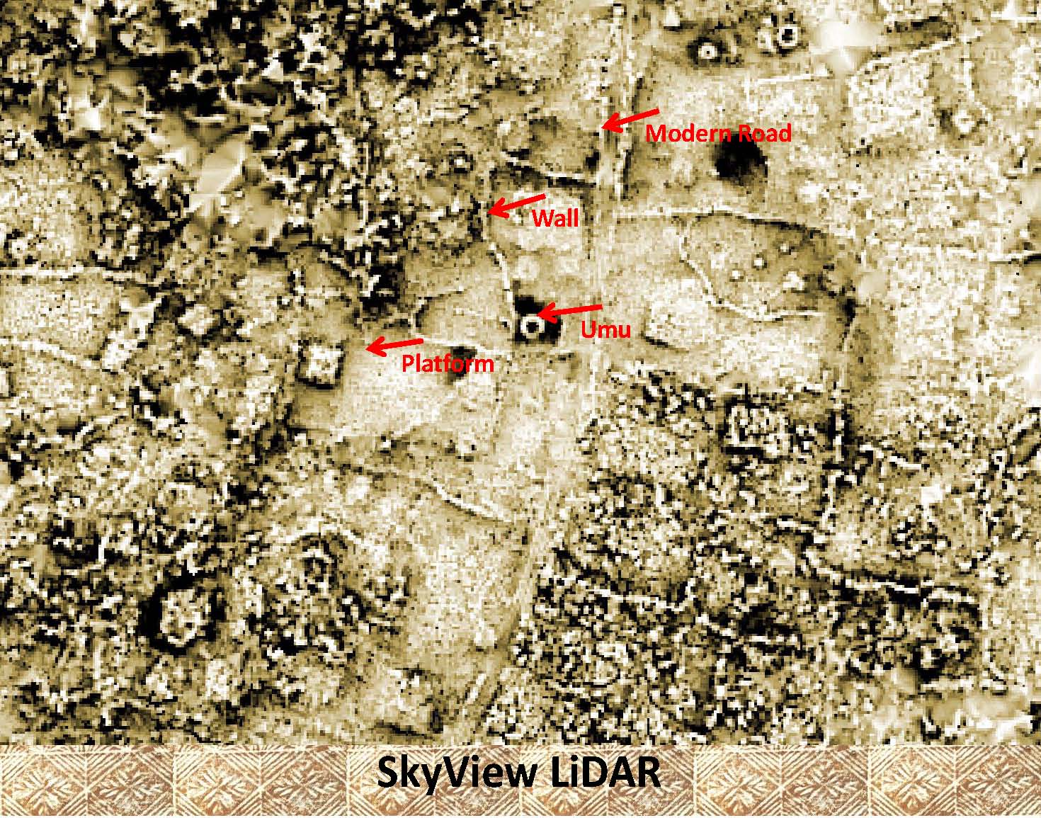
This is the same platform as above as it appears on LiDAR. Notice how easy it is to pick out the large platform. There are numerous other platforms, walls, umu and walkways in the area. |
|
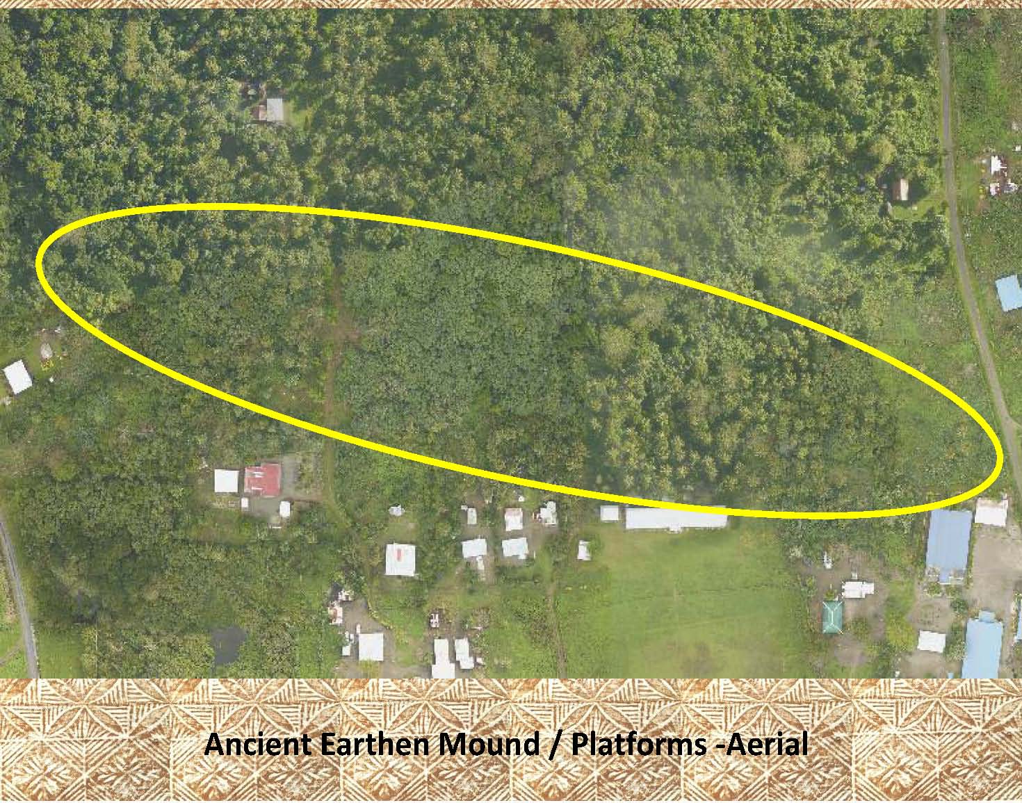 |
Hidden in the forest below, only 200 meters from the coast, is a complex of more than 6 large earthen platforms in the village of Sapunaoa on the south coast of Upolu. The largest of these platforms is 50 x 50 meters. Can you see them? There location has been marked. See the next LiDAR image for a better view. |
|
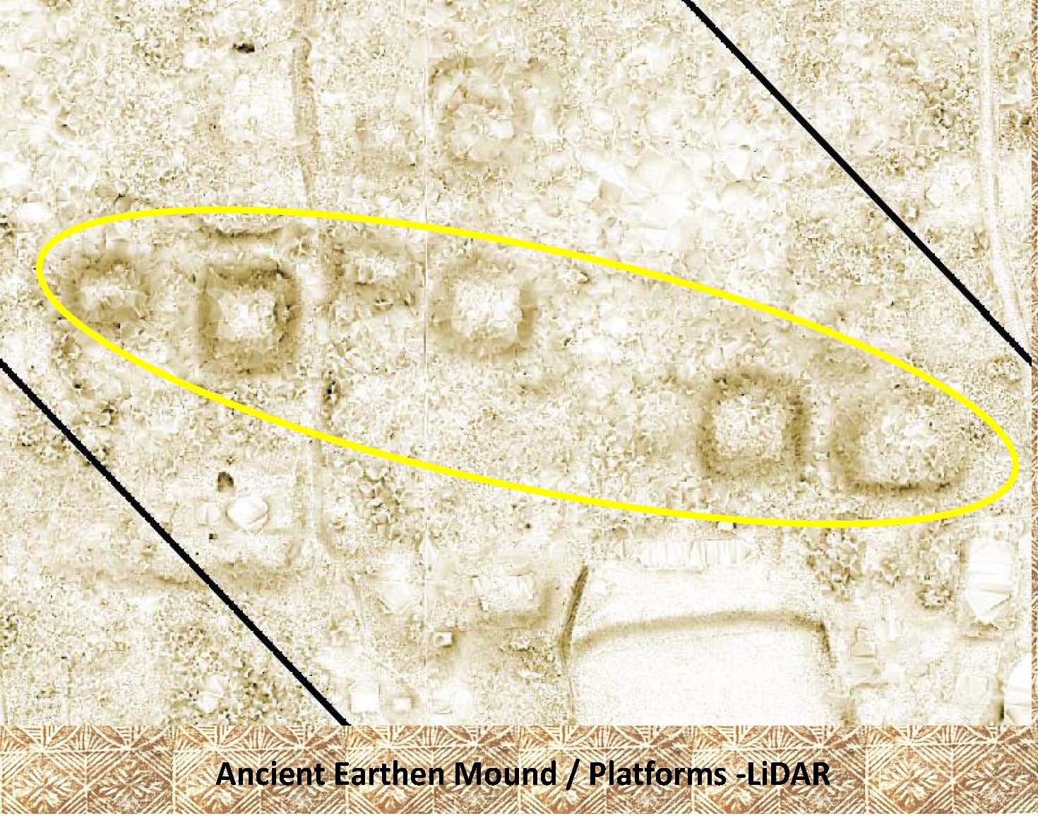 |
With the LiDAR image it is easy to pick out the platforms, even though the forest cover seen in the aerial photo above. As with many of the archaeological features see on LiDAR these have not yet been visited or surveyed. |
|
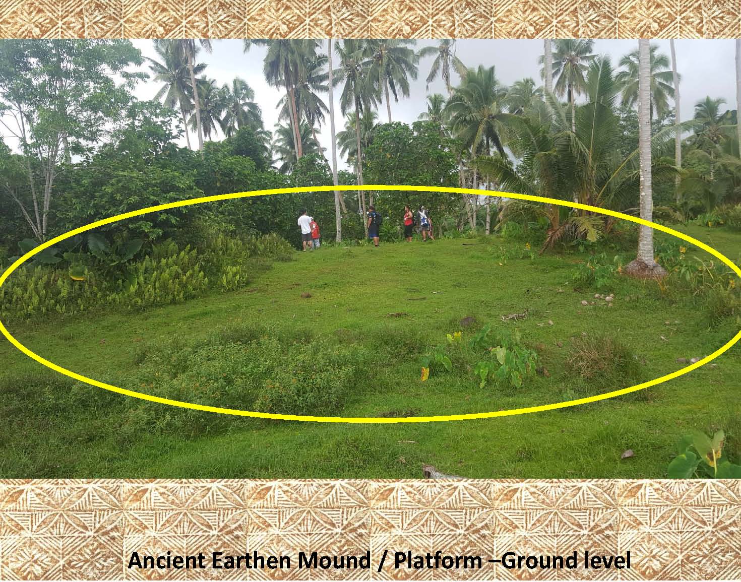 |
Here is a ground level photo of a large earthen platform at the north western end of the village of Saolufata, Upolu about 2 km. from Fusi on the coast to the north. This platform is from 4 to 6 meters tall and 100 x 80 meters in size. This photo only shows the north west corner of the platform. Notice the size of the platform in relationship to the people on top of it. |
|
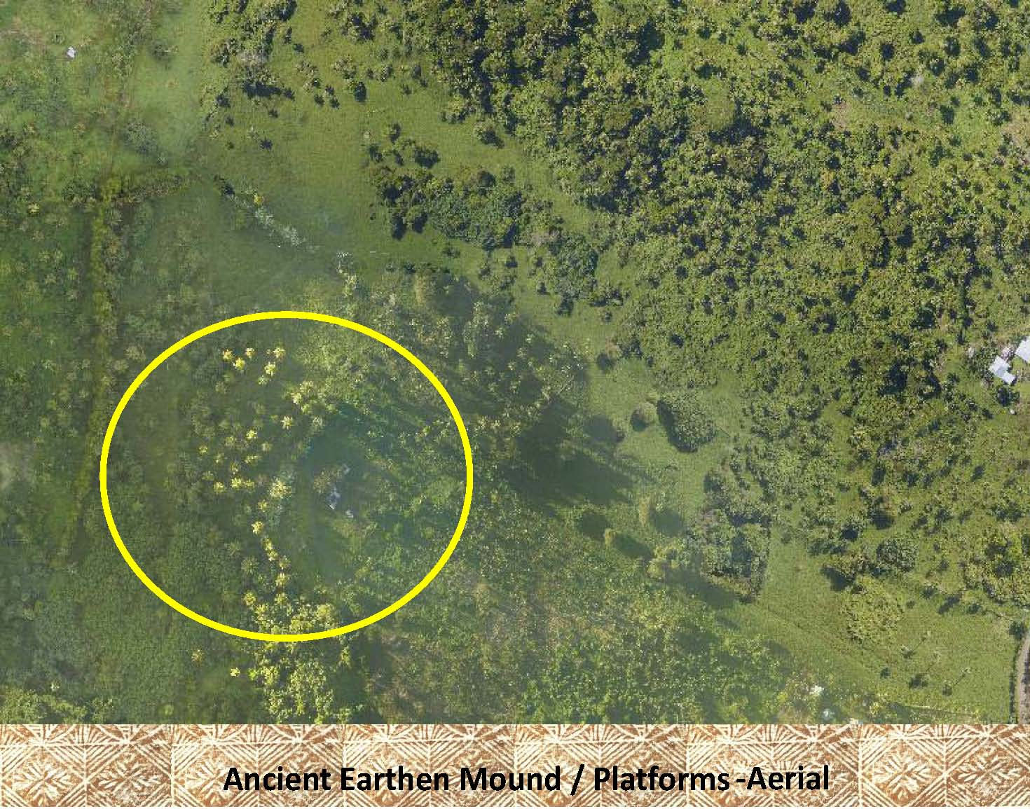 |
Although the large platform seen above has been highlighted in this aerial photo it is, as has been observed for other archaeological features in other aerial photos, very difficult to see |
|
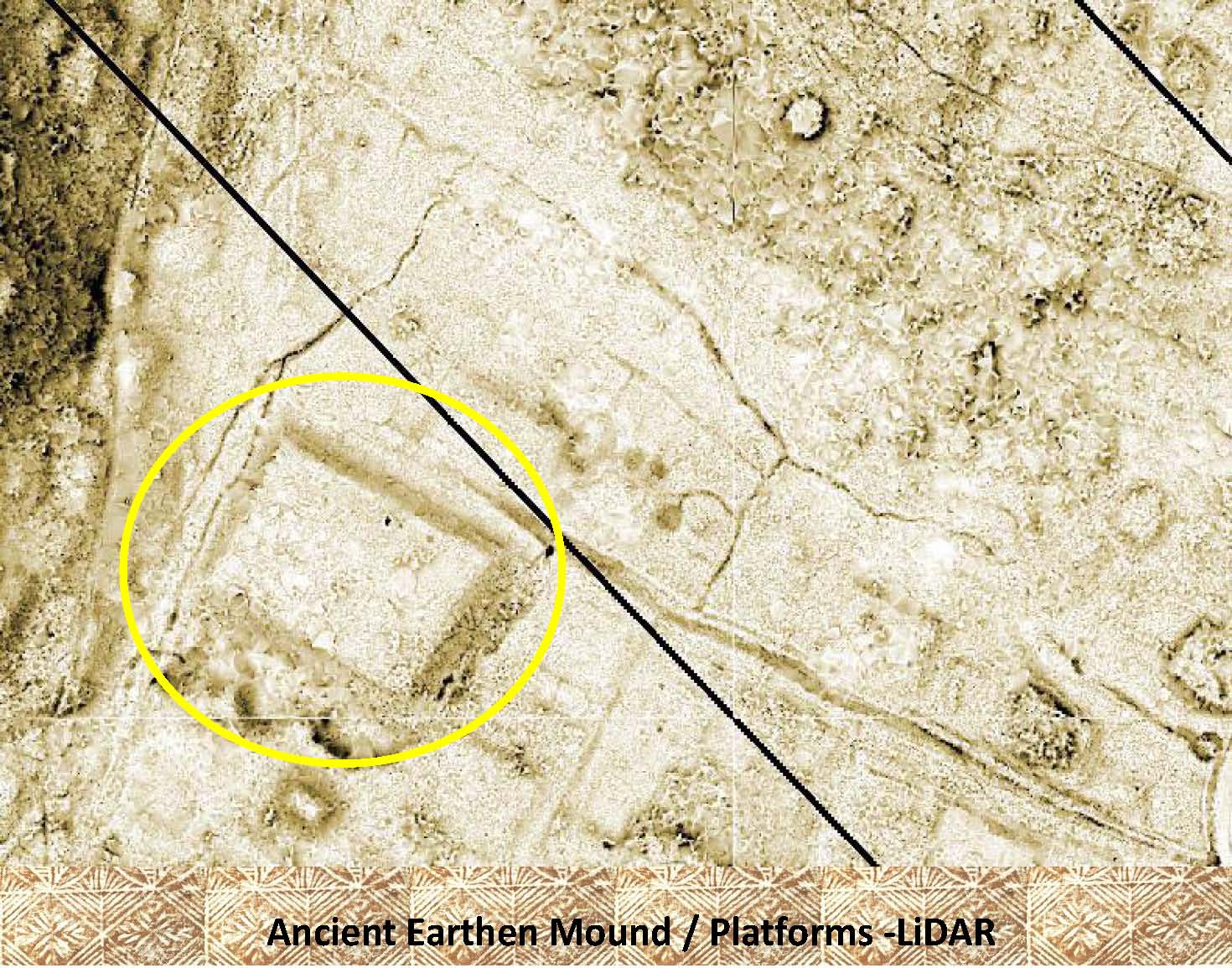 |
Even though the platform seen above has been marked in this LiDAR image it is very easy to see. Can you make out the other features in this image? Did you see the star mound at the top of the LiDAR image? |
|
|
References: Additional information about platforms can be found in the following publication: Green and Davidson (1969) Archaeology in Western Samoa, Volume 1, Pp 39-41 Green and Davidson (1974) Archaeology in Western Samoa, Volume 2, Pp 225-227 Davidson (1969) Settlement Patterns in Samoa Before 1840 Jennings, etal (1980) Samoan Village Patterns: Four Examples |