In 1974 Davidson wrote, “Among the more dramatic field monuments in Western Samoa are the fortifications, …” (Green & Davidson 1974), this is no less true today than it was then. Her description that, “The most common form is the ditch and bank, or combination of several ditches and banks, extending across a ridge from gully to gully.” also fits well with the current LiDAR evidence. Although, as with other features, many more forts are being found using LiDAR than were evident through village inquiry and pedestrian survey alone. Although the ditch and bank fortifications were the most common, others forms are known. For more details see the References section at the end of this tutorial. In the following photos we have tried to make the reader familiar with what these forts look like not only on LiDAR, but also at ground level and in aerial photos. |
|
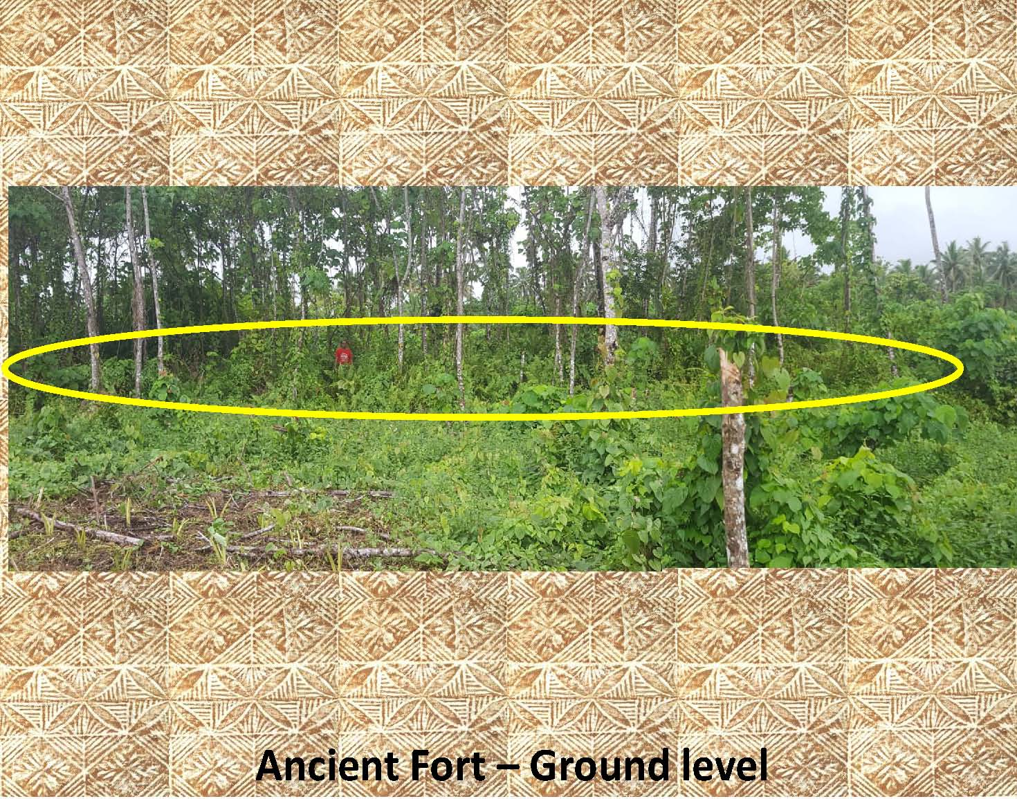
This is a ground level photo of a ditch and bank fort (outlined) found in the Alaepata district of Upolo. It is entirely covered with vegetation and difficult to see at a distance and therefore it has been outlined in this photo, but the fort itself is readily evident upon close inspection of the ditch and bank feature. Note the person standing on the top left side of the fort (red shirt). This fort is a little over a meter tall on the banked east side (where this photo is taken) and a little over 2 meters tall on the ditched west side (there the vegetation was too thick to allow any useful photographs). |
|
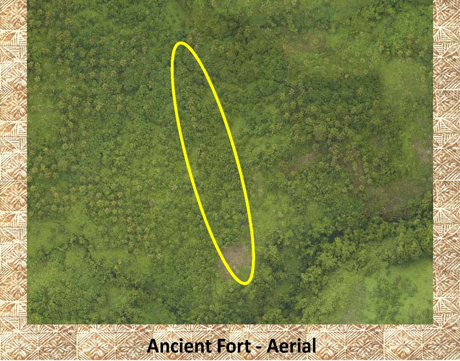 |
In the aerial photo on the left is the fort shown above, again the fort is highlighted as it is entirely covered in vegetation and very difficult to pick out in the aerial photo. This fort is 2.8 km. inland from the coast above the modern village of Utufaalalafa, Upolu. |
|
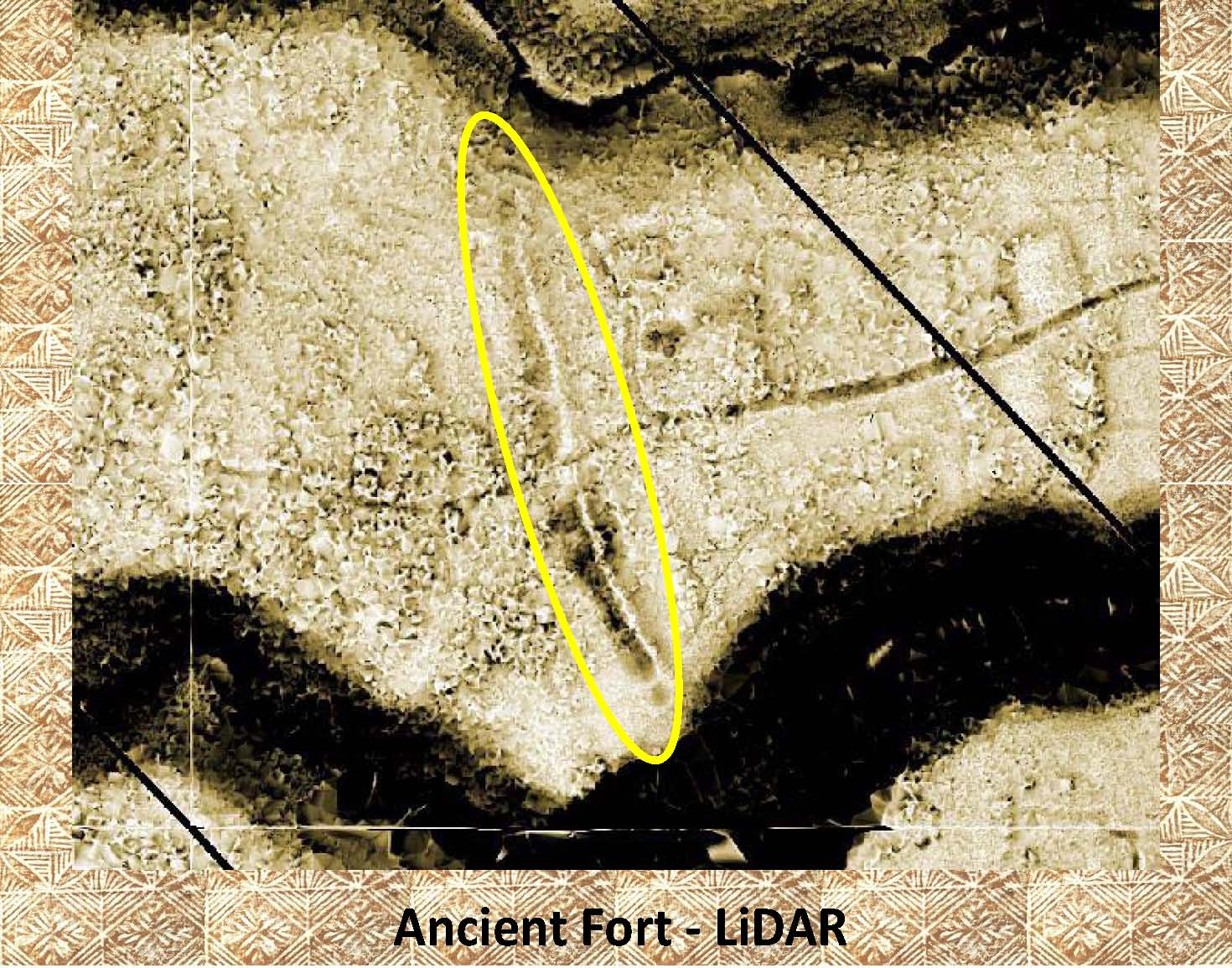 |
In this LiDAR image (of the fort above) it is very easy to see the ditch and bank fort marked on the LiDAR and the modern road that cuts thru the fort from east to west. Also notice the darker area on the left (west/inland) side of the fort. This darker area on the Sky-view LiDAR indicates the deeper (darker) side of the ditch and bank construction. Another important attribute of the fort that can be seen in this LiDAR image is the fact that the fort traverses the ridge from the intermittent stream on the top (north) side of the plateau (dark area) to the intermittent stream on the bottom (south) side of the plateau (dark area). |
|
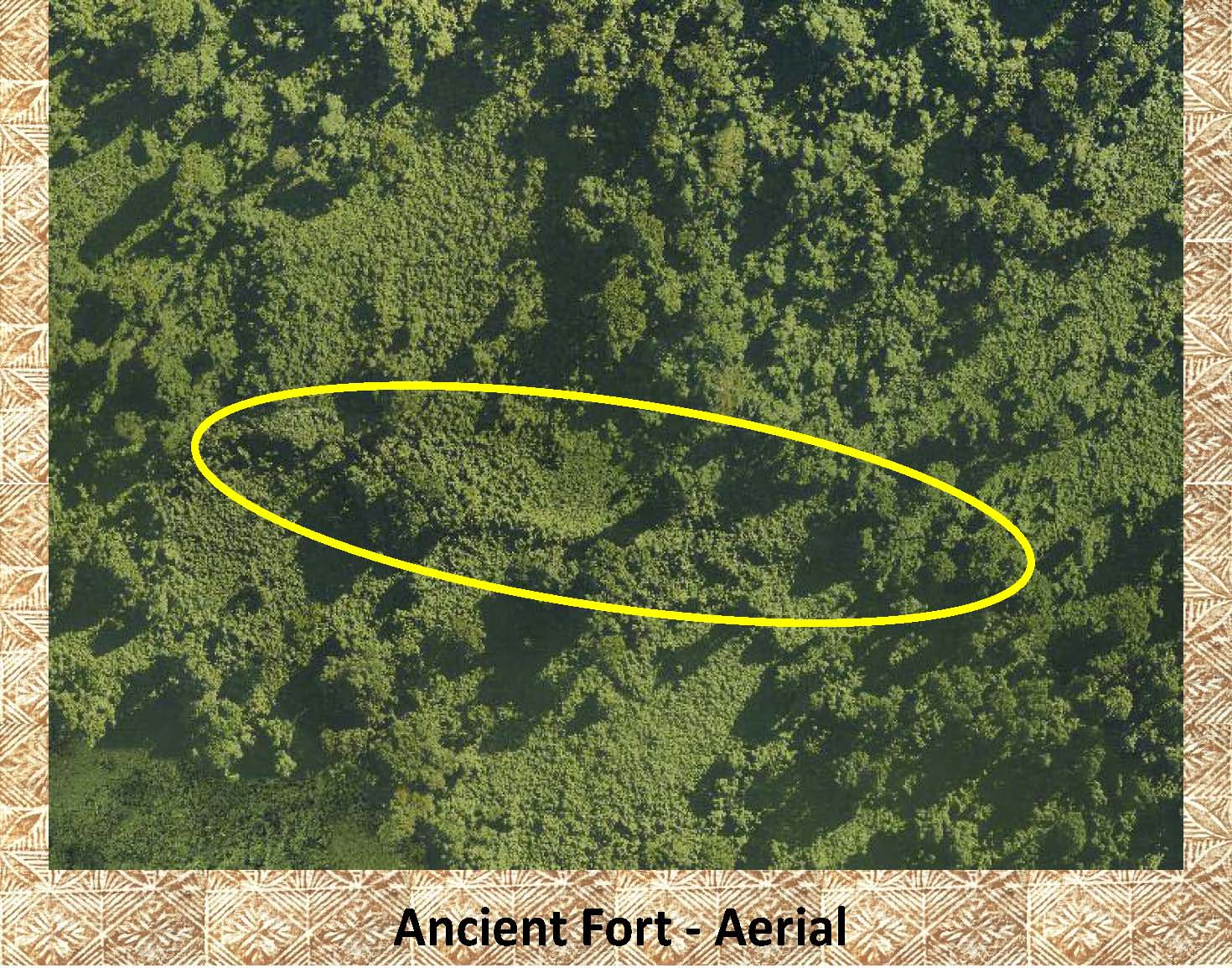 |
This is an aerial photo from the south side of Upolu about half way down the coast. This fort is about 4.5 km. inland above the national park near Saleilua. Again the fort has been marked as it is difficult to see as it is heavily covered with vegetation. |
|
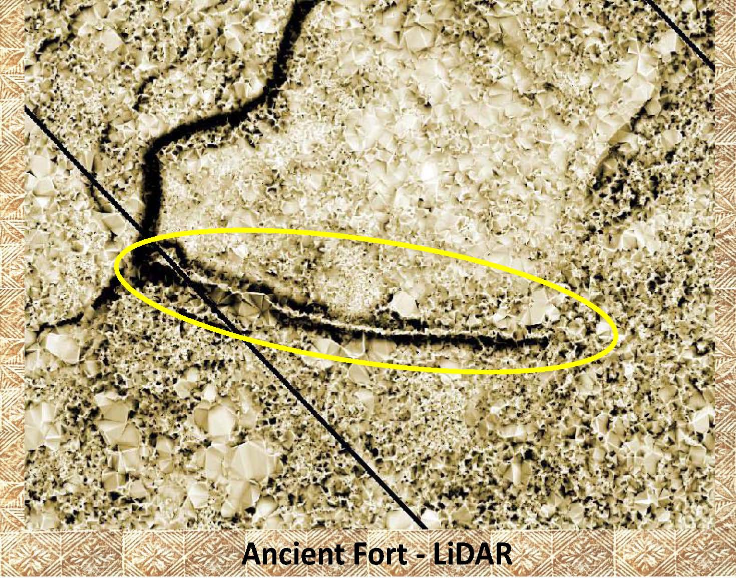 |
Here is the same fort as in the aerial photo above. As in the other LiAR image above it is readily visible on LiDAR stretching from stream to stream. This fort has not been visited but is easily visible on LiDAR. |
|
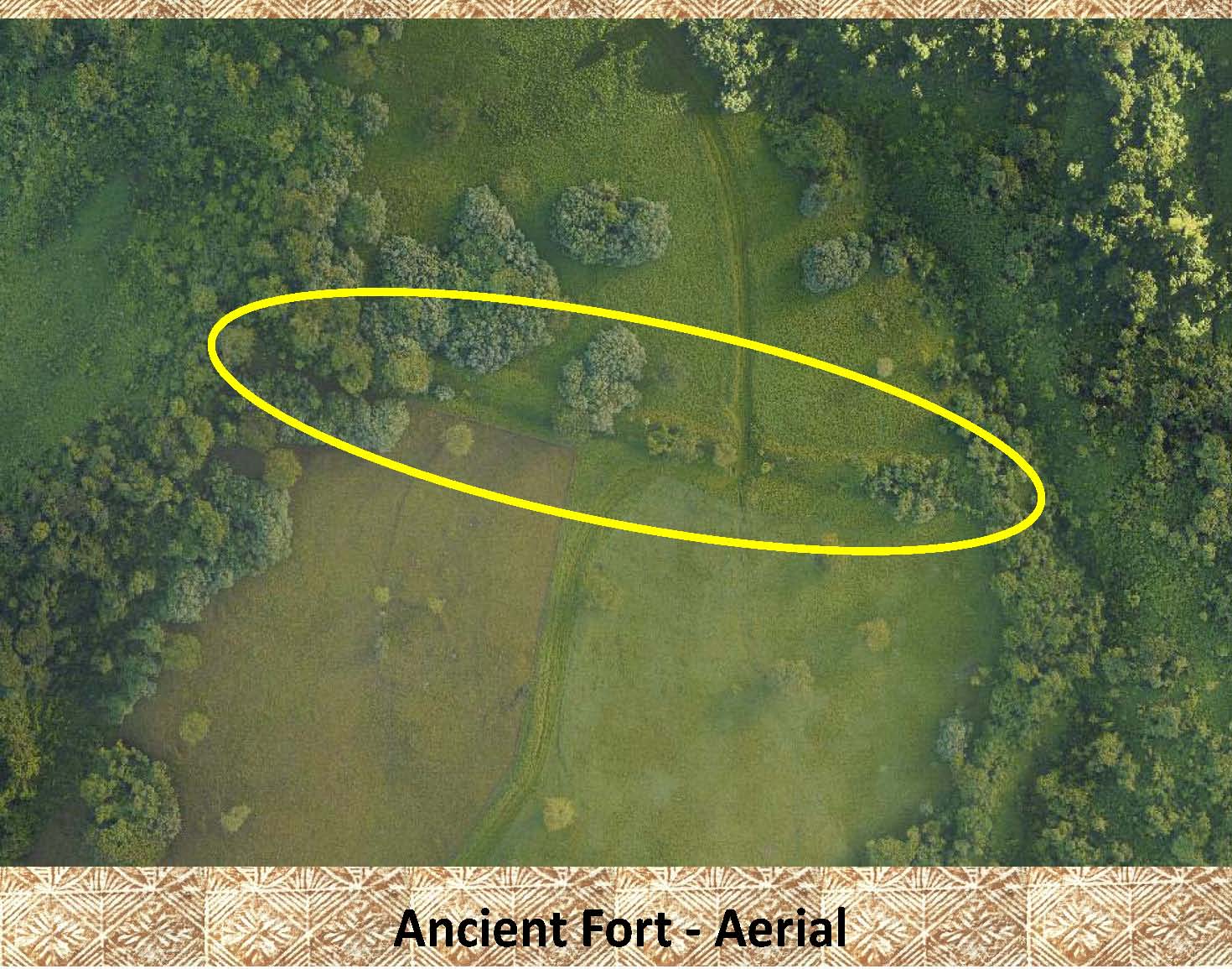 |
As much of the vegetation covering this fort has been removed it is easier to see on this aerial photo. Notice, again, it stretches between the streams. Also, notice again a modern road built through it. This fort is in the same general area (1.8 km. NW) of the fort shown above. It is approximately 5.5 km. inland. |
|
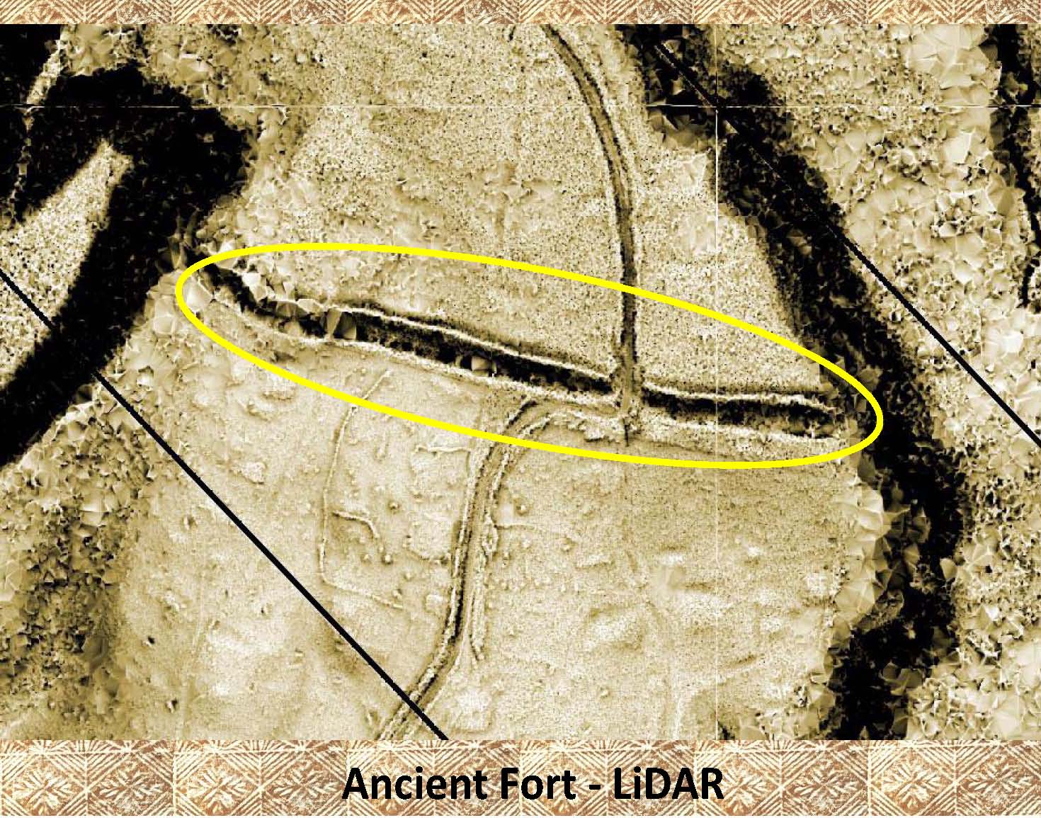 |
Again, as above, the LiDAR image plainly shows the ditch and bank fort. Notice, this time the dark band (deep side of the ditch) is to the bottom of the photo (this time it is on the sea ward side of the fort). |
|
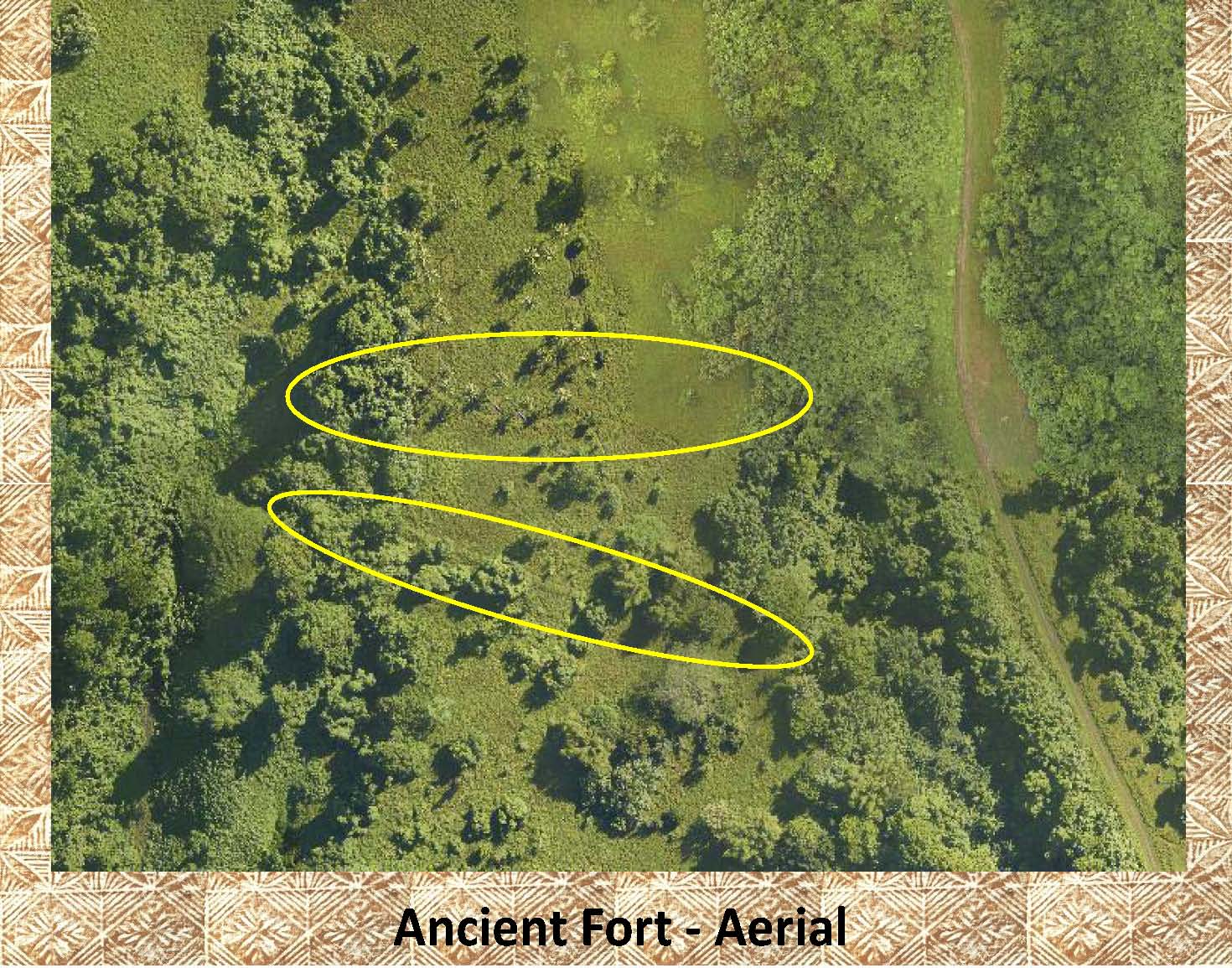 |
This aerial photo shows 2 forts in close spatial proximity to each other (50 m. apart), though their temporal relationship is unknown. Neither of these forts has been visited. |
|
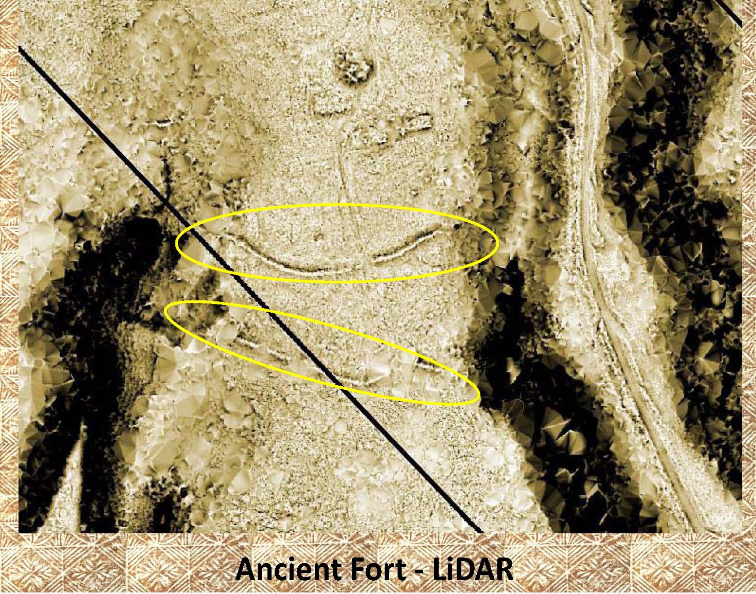 |
As above, the LiDAR image makes it easy to see both forts. In the top fort notice the top of the ditch and bank is darker. In a Sky-view LiDAR image this implies that the deeper part of the ditch is on the inland (top) side, this is atypical. Whether this was done because it was easier to move dirt downhill, or if it was done to provide protection for inland attack is unknown. In other ditch and bank forts it has been assume that they were built to protect from sea ward attacks. Again, notice that a modern road bisects the forts. |
|
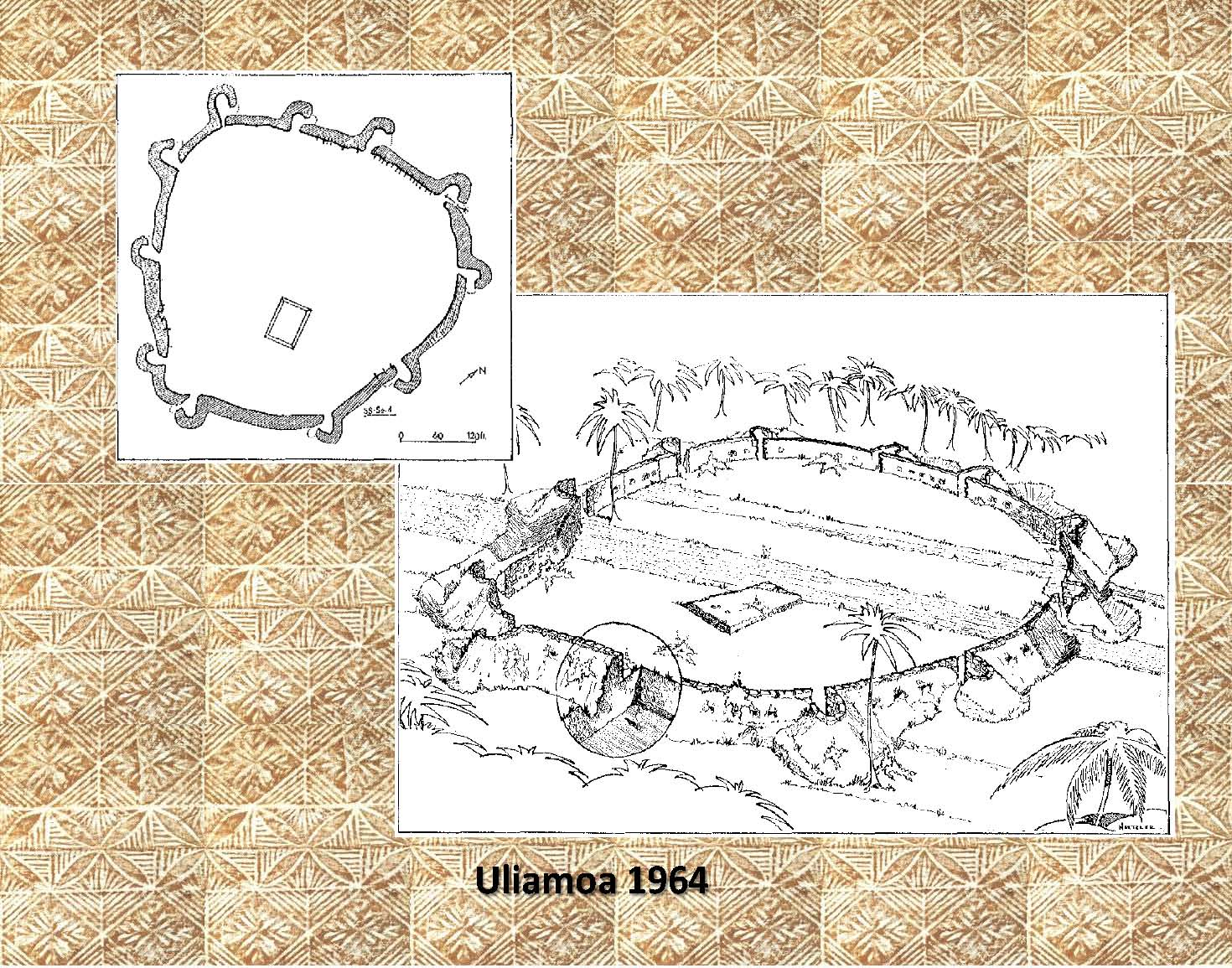 |
These are sketches from Green and Davidson (1969) of the atypical fort know as Uliamoa 3.5 km. inland of Vaega, Savaii (See: Who Built Uliamoa? in the Reference section below for more information). |
|
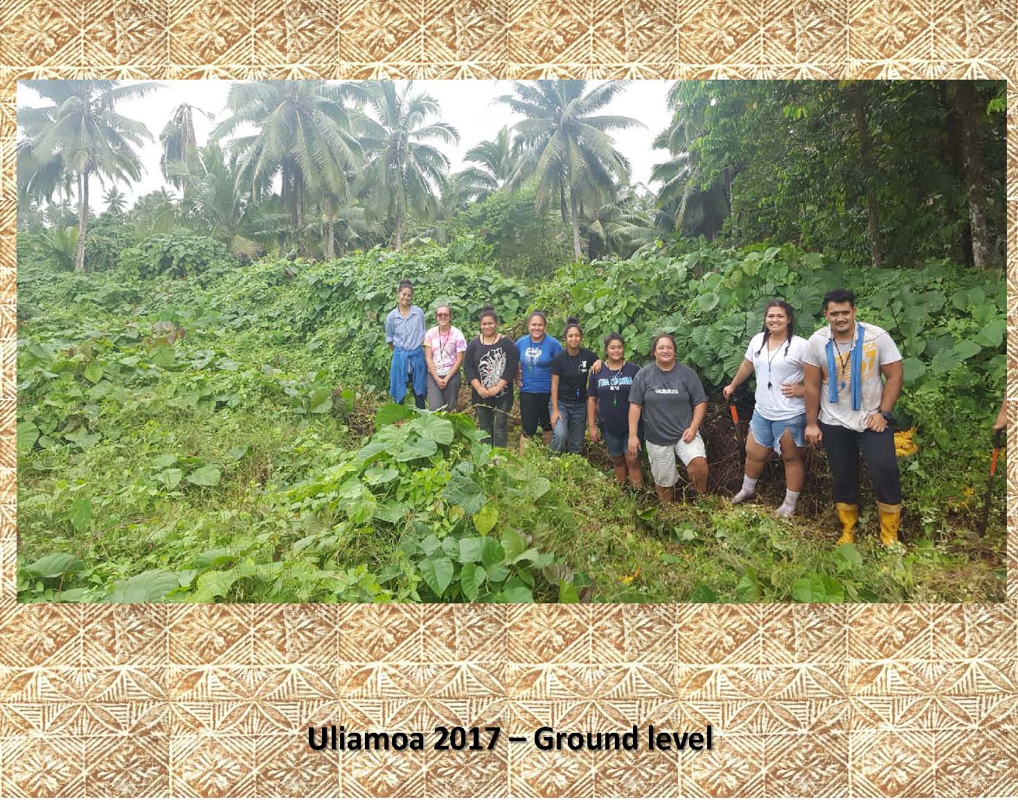 |
This photo was taken of the inside southern wall of Uliamoa in 2017. Notice not only the height of the stone wall that makes up the fort in the background, but also the fact it is totally covered with vegetation. This photo was taken on the east side of the plantation road less than 20 meters east of where it cuts through the southern part of the fort (see 3d image below). |
|
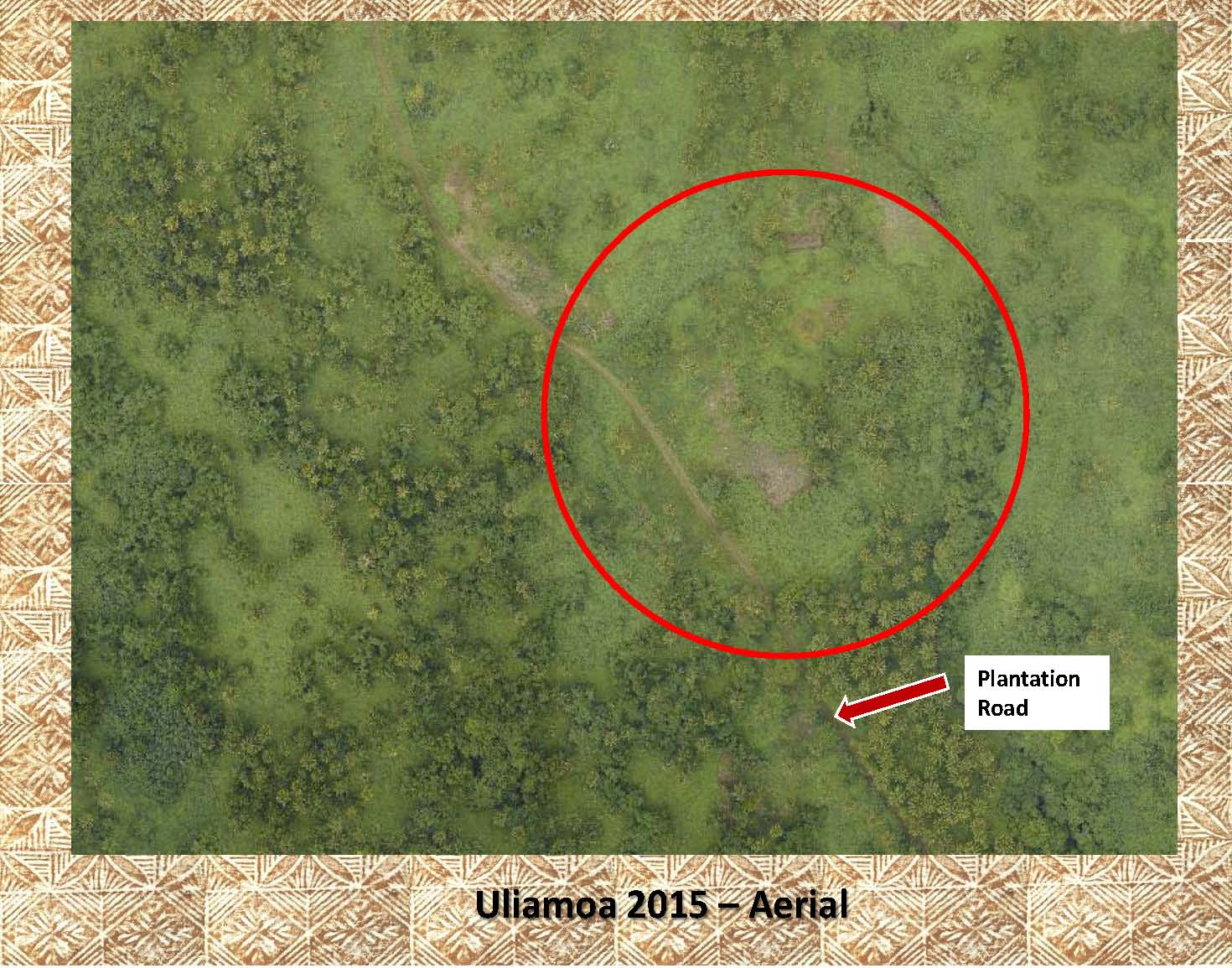 |
Uliamoa has been marked in this aerial photo as it is difficult to see. Notice the modern road that cuts through the western side of the fort in 2 places. |
|
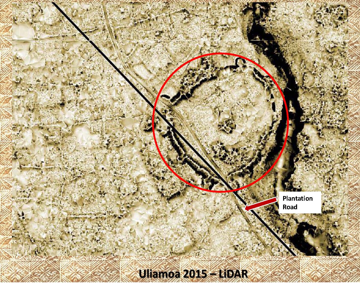 |
This is the LiDAR image showing Uliamoa. Notice the resemblance to the Green & Davidson shetches above. Also, note the modern plantation road cutting through the western edge of the fort. |
|
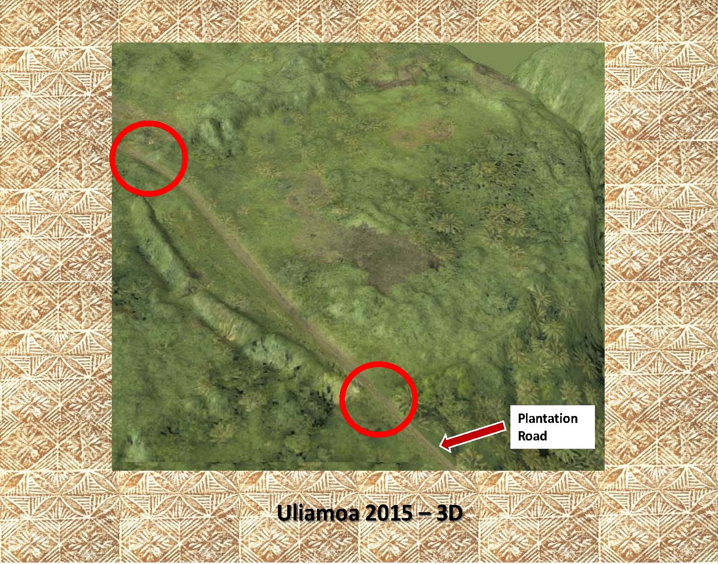 |
This final image is a 3d rendering of the aerial photo from above. Notice the road cuts (red circles). This is an all to common occurrence in archaeological features in Samoa. |
|
|
References: Additional information about forts can be found in the following publication: Green and Davidson (1974) Archaeology in Western Samoa, Volume 2, Pp 240-242 Best (1993)At the Halls of the Mountain Kings. Fijian and Saoan Fortifications Green (2002)Interpretations of Samoan Fortifications Barns & Green (2008)Who Built Uliamoa, Pp 71-78 |