Elevated Walkways, or raised pathways, consist of an elevated path made of rock and or earth. They vary from relatively simple raised earthen surfaces only tens of centimeters high and a meter or less across, sometimes lined on the side with stone, to large stone causeways a meter or more in height and several meters wide. These were presumably used, as the name implies, as corridors of human transport, but in many instances go far beyond the basic level need to accomplish such a task. In some locations they are often overlaid by modern roads leading from the village into the plantation, although many still lay undisturbed in the plantation land above the modern villages. They reach deep into the upper reaches of the village land (and possibly beyond). Their lateral branches sometimes connect to adjacent pathways producing a network of interconnected walkways (also see Walled Walkways in this tutorial which serve a similar purpose and are often parts of this network). It is not uncommon for an extensive walkway to alternate between walled and elevated sections. It has been assumed that they play an important role not only in basic transport but also in emphasizing social status. They have been found throughout Samoa. For a more complete description see the References at the end of this tutorial. In the following photos we have tried to make the reader familiar with what these elevated walkways look like not only on LiDAR, but also at ground level and in aerial photos. |
|
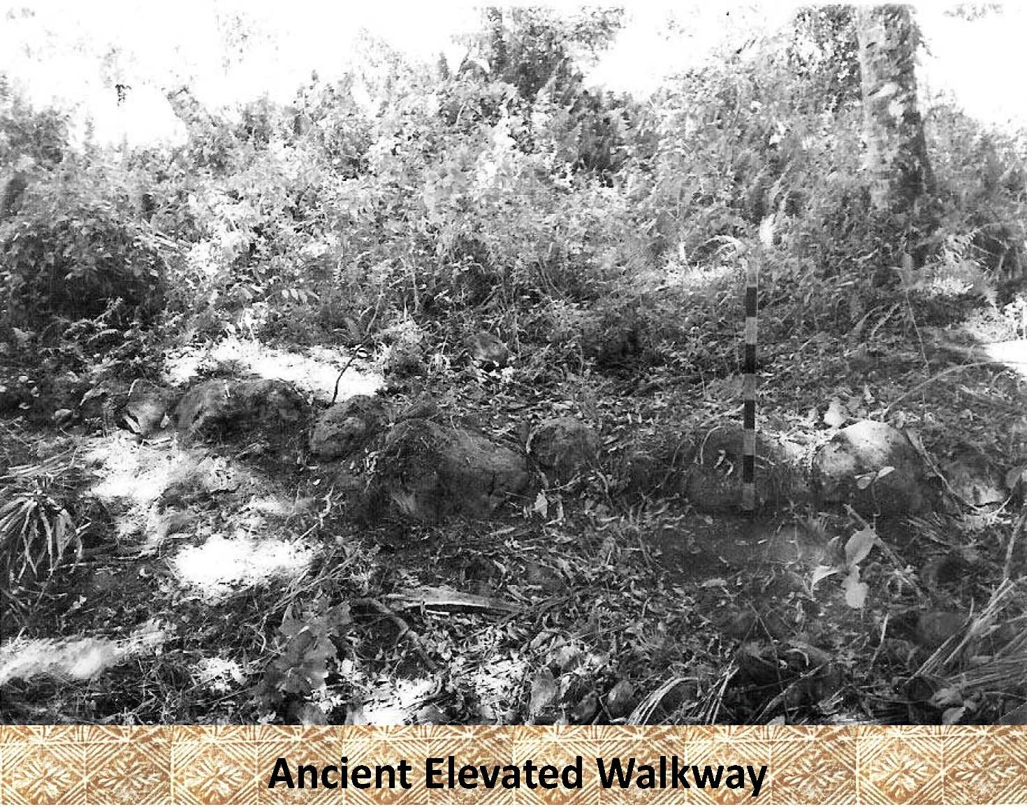
This is an example of a low elevated rock lined earthen walkway at ground level (it is outlined in the next photo). Note the 1 meter, black and white photo scale on the right side of the photo. |
|
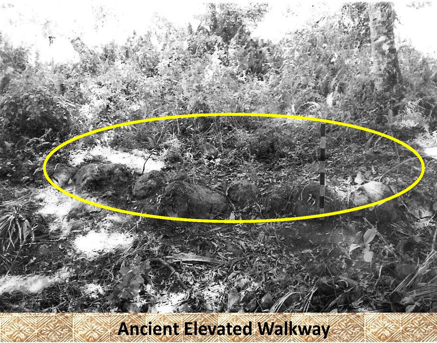 |
In this photo the walkway has been outlined as it is difficult to pick out in the previous photo. |
|
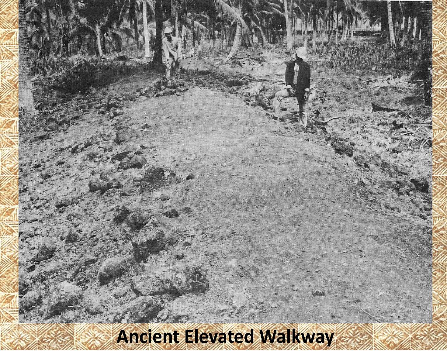 |
This is an example of a much more massive earth and rock elevated walkway that has been completely cleared of vegetation. It is over a meter tall and several meters wide. As can be seen in the photo it has been greatly degraded over time, but still retains its basic shape and earthen surface paving. |
|
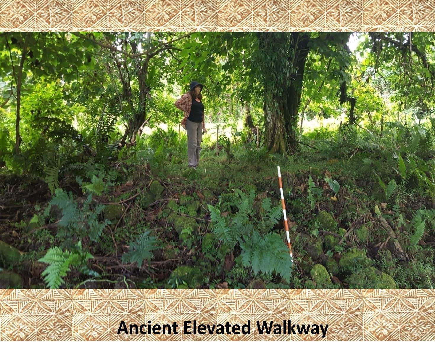 |
This photo shows a stone, elevated walkway (causeway) almost a meter in height and several meters wide still heavily covered with vegetation. Note the orange and white meter tall photo scale in the center of the photo as well as the person (for scale). The age of this stone walkway is evident by the massive tree growing on its surface. |
|
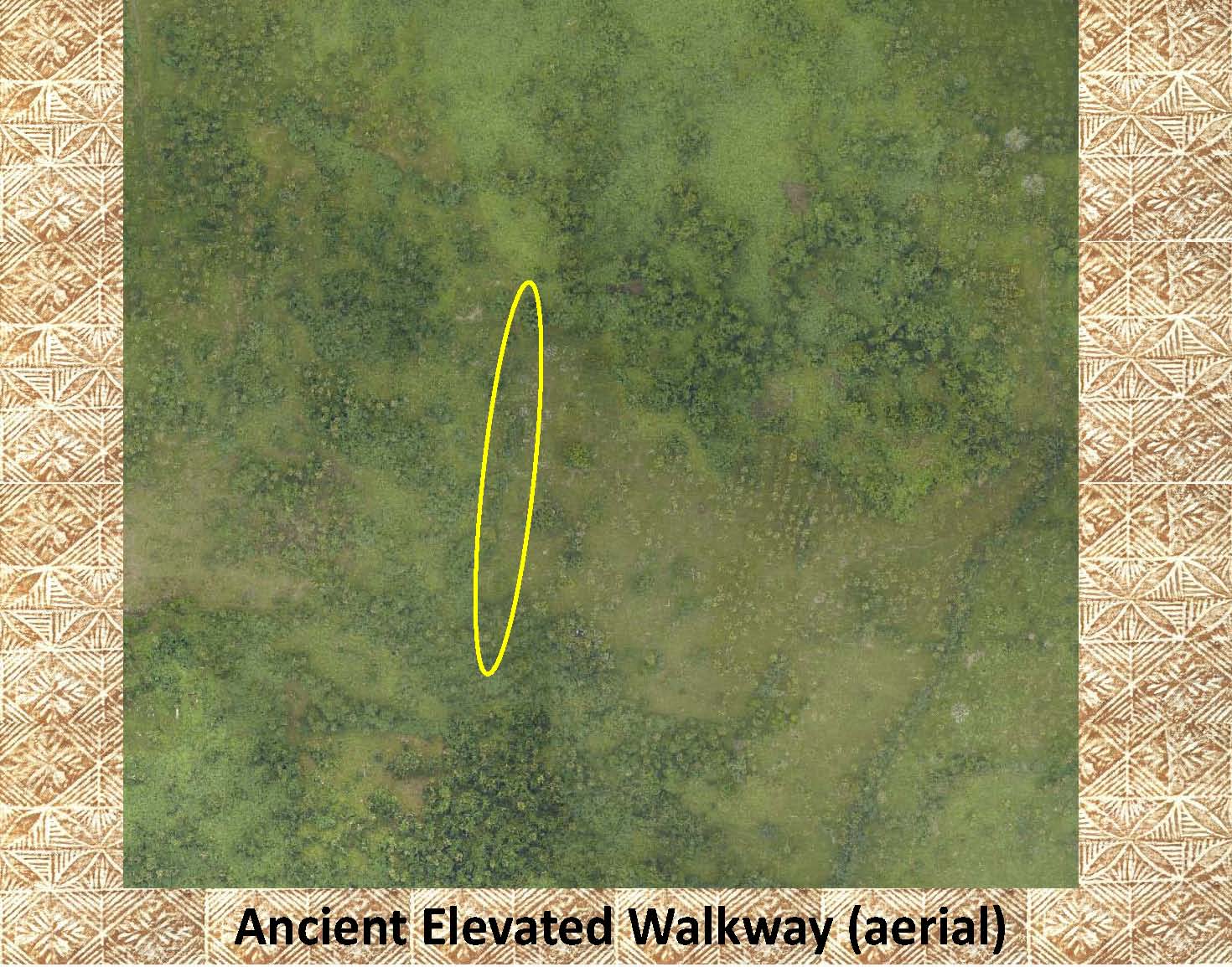 |
In this aerial photo the elevated walkway has been marked. It is difficult to see, but is evident by the vegetation covering its surface (the dark green line/splotches in the center of the yellow ellipse). |
|
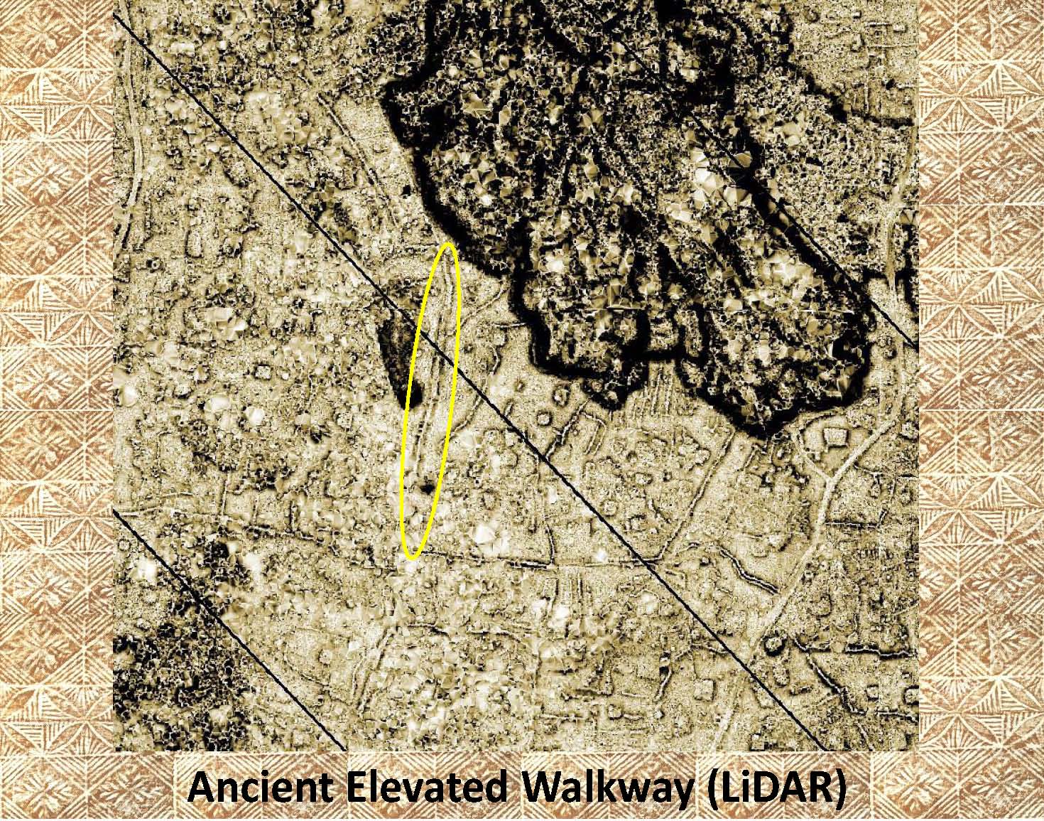 |
This LiDAR image is of exactly the same area as shown in the previous aerial photo. Note how easily the elevated walkway is observed once the vegetation has been “removed”. Notice the other possible walkways in the area. |
|
|
References: Additional information about elevated walkways, or raised pathways, can be found in the following publication: Green and Davidson (1969) Archaeology in Western Samoa, Volume 1, P 38 Green and Davidson (1974) Archaeology in Western Samoa, Volume 2, Pp 238-240 Jennings, etal (1980) Archaeological Excavations in Western Samoa |